Agrinio, Aetolia-Acarnania, West Greece 作者: 来源: 发布时间:2021-03-30
I. Population, Area and Transportation
Total Area: 1,229.33 km2 (474.65 sq mi)
Elevation: 91 m (299 ft)
Municipal unit density: 86/km2 (220/sq mi)
Population: 106,053 (2011)
II.Natural Geography
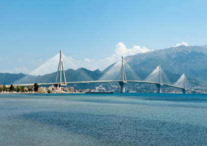
Mountains dominate the north, northeast, west and southeast, especially the Acarnanian Mountains. The longest and main river is the Acheloos, which ends as a delta in wetlands to the southwest on a rich fertile valley. The second longest is Evinos; others include the Ermitsa, the Inachos, and the Mornos (on the border with Phocis). The regional unit excludes the islands lying to its west, since they belong to the Kefalonia and Ithaca regional units. There is one reservoir and a lake in its central part. The many mountains of the area span the Panaitoliko toward the northeast and the Acarnanian Mountains, the Valtou and the Makrynoros mountains in the north, the Nafpaktia Mountains in the southeast, the Arakynthos and Kravara in the south.
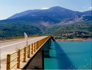
Lakes include the Amvrakia, the Lysimachia, Ozeros, and Trichonida, and artificial lakes and reservoirs include Kastraki, Kremasta, the largest lake in Greece since its creation in 1970, and Stratos. Two lagoons are found in the southern part of the regional unit: the Messolongi and the Aitoliko. The lowest altitude in Greece is found in west Aetolia-Acarnania at about -10 meters from the sea level.
Climate
Its climate ranges from hot and humid summers, with temperatures often surpassing 40 °C, to mild and short winters in the low-lying areas, with cool winters dominating in the mountain areas. At the highest elevations, summers are cool, and snow and cold weather dominate the winter months in the Panaitoliko.
III. Economy
During the Interwar period, in spite of economical crisis, works of infrastructure took place in the city, like the paving of streets and the installment of electricity, while a water tower was installed in 1930. At the same time excavations revealed the ancient city of Agrinion. Growth and prosperity returned after World War II and the Greek Civil War. This growth was boosted by the building of two major hydroelectric dam installations at Kremasta and Kastraki, on the north of the city. The tobacco industry and olive tree cultivation became the main income sources of the city.
IV.Attractions
1.Lake Trichonida
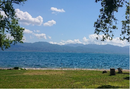
lLake Trichonida is the largest natural lake in Greece. It is situated in the eastern part of Aetolia-Acarnania, southeast of the city of Agrinio and northwest of Nafpaktos. It covers an area of 98.6 square kilometres (38.1 sq mi) with a maximum length of 19 kilometres (12 mi). Its surface elevation is 15 metres (49 ft) and its maximum depth is 58 metres (190 ft).
lOne million years ago the lake was much larger, and covered the central part of Aetolia-Acarnania, a part that is now a plain. The Panaitoliko mountains are situated to the north and northeast of the lake. The municipal units surrounding the lake are (from the east and clockwise) Thermo, Makryneia, Arakynthos, Thestieis, and Paravola. Around the lake, there are beautiful forests with maples, pines and other trees. The lake and its environs is home to more than 200 bird species. There are also farmland and various villages surrounding the area. The hydrocarbon lake Trichonida Lacus on the Saturnian moon Titan was named after this lake.
References
https://webcache.googleusercontent.com/search?q=cache:0ria4J1woEgJ:https://en.wikipedia.org/wiki/Lake_Trichonida+&cd=1&hl=zh-CN&ct=clnk&gl=us&lr=lang_en%7Clang_zh-CN
2. Temple of Zeus in Stratos
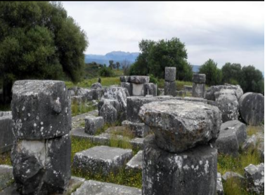
lAncient Greek design and building practices underwent a gradual shift during the Classical and Hellenistic periods, from the fifth to the second century BC. Most architectural scholars agree that simple arithmetical proportions are a key to understanding Classical and Hellenistic can be regarded as being based on a fixed-size module, and what was the range of foot-units used in the Hellenic world. In order to better understand the principles of building design and the relationship between tradition and innovation in Late Classical and Early Hellenistic architecture, it is necessary to carry out new detailed investigations of individual buildings: the target of this research is the unfinished Doric temple of Zeus at Stratos in Western Greece, built at the very end of the fourth century.
IV. History
According to mythology, the ancient city of Agrinio (situated in the area of Megali Chora) was built by king Agrios, son of Portheus and a great grandson of Aetolos (king of Plevron and Calydon) around 1600-1100 BC. The town, built near the banks of river Achelous (the natural border between Aetolia and Acarnania), was claimed by both states during ancient times. Agrinio became member of the Aetolian League and it was later destroyed by Cassander in 314 BC during the League's wars against the Kingdom of Macedonia.
lThe city reappears during the Ottoman period with the name Vrachori and apart from its Greek population it was also inhabited by many Turks (Muslims). In 1585 it was deserted during the revolt of Theodoros Migas. At the beginning of the 18th century it became the administrative centre of Aetolia-Acarnania (then as the sanjak of Karleli), depended on the imperial harems. Vrachori participated in the Greek Revolution and was temporarily liberated on June 11, 1821. In August 1822, while Reşid Mehmed Pasha's (Kütahi) troops were marching towards Vrachori, its citizens decided to burn and evacuate their city, following the strategy of scorched earth. The deserted city was recaptured by the Turks. The city was finally included in the borders of the newborn Greek state permanently in 1832 with the Treaty of Constantinople (July 9, 1832) and was renamed after its ancient name, Agrinion.
lIn the years following the liberation, Agrinio went through an important growth and development, especially at the end of the 19th century and the dawn of the 20th. After the Greco-Turkish War and the Asia Minor Catastrophe, many refugees from Asia Minor (western Turkey) arrived in the city and settled in the district of Agios Konstantinos. At the same period there was an important internal immigration to Agrinio from the whole Aetolia-Acarnania region, along with immigration from the areas of Epirus and Evrytania.
lDuring the Interwar period, in spite of economical crisis, works of infrastructure took place in the city, like the paving of streets and the installment of electricity, while a water tower was installed in 1930. At the same time excavations revealed the ancient city of Agrinion. Growth and prosperity returned after World War II and the Greek Civil War. This growth was boosted by the building of two major hydroelectric dam installations at Kremasta and Kastraki, on the north of the city. The tobacco industry and olive tree cultivation became the main income sources of the city.
