Balbriggan,Leinster 作者: 来源: 发布时间:2021-06-17
I.Population and Area
Location in Ireland
Coordinates: 53.610°N 6.184°WCoordinates: 53.610°N 6.184°W
Country Ireland
Province Leinster
County Fingal
Dáil Éireann Dublin Fingal
EU Parliament Dublin
Elevation 6 m (20 ft)
Population (2016)
• Total 21,722
Time zone UTC±0 (WET)
• Summer (DST) UTC+1 (IST)
Eircode routing key K32
Telephone area code +353(0)1
Irish Grid Reference O200641
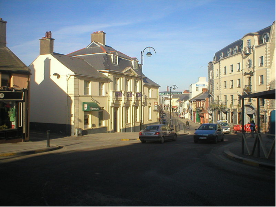
Balbriggan is a town 34 km from Dublin in the northern part of Fingal, Ireland. The 2016 census population was 21,722 for Balbriggan and its environs.
II.Natural Geography (environment and resources)
Geography
The River Bracken, also known as the Matt River, which flows through the town, once formed a lake known locally at "the Canal" or "Head"(of water). The water was sluiced through a canal and tunnels down to the Lower Mill where it turned a waterwheel to drive the cotton manufacturing machinery. The retaining wall of the reservoir collapsed in the 1960s and the area was reclaimed through land-fill in the early 1980s to create a public park.
On the northern edge of the town, the small Bremore River comes to the sea just beyond the Martello Tower.
Location and access
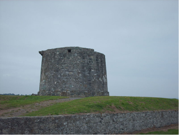
Martello tower at Balbriggan
Balbriggan is 32 km north of Dublin city, in the northern part of the traditional County Dublin. It lies on the Belfast–Dublin main line of the Irish rail network. Commuter rail services serve Balbriggan railway station, which opened on 25 May 1844 and closed for goods traffic on 2 December 1974. It is estimated that about 2,200 commuters use the station every working day.
The town is also located next to the M1 motorway (the section known as the Balbriggan Bypass), which was completed in 1998. Prior to this, the main Dublin-Belfast road went through the centre of the town, with major traffic congestion on a daily basis.
Bus service is provided by Dublin Bus routes 33, 33A (taken over by Go-Ahead Ireland on 2 December 2018) and 33X as well as Bus Éireann routes 101 (Dublin-Drogheda) and 104 (Balbriggan Town service).
It is the most northerly town in Fingal (although the village of Balscadden lies further north within the county), and is situated close to Bettystown, Laytown (County Meath) and Drogheda (County Louth).
Balbriggan experienced a population boom in the early part of the 2000s as a result of the large demand for housing within the wider Dublin region. The population has increased as a result, with hundreds of new homes being built.
Population
In 2011, approximately 31% of the town's population is classified as being non-ethnic Irish, with about 12 per cent being of black background. The population of the town and its environs rose to a figure of almost 23,000 in 2015.
III.Economy
The Department of Foreign Affairs has located a passport production facility in Balbriggan. There is also a proposal to relocate the Drogheda International Seaport to the Bremore Port area to the north of the town. Local development bodies expect that the proposed Bremore Port and orbital motorway projects as well as the existing M1 motorway and Belfast – Dublin railway are major draws to prospective companies with large logistical sectors hoping to expand or set up in the Fingal area.
Balbriggan Town Hall served as home to Balbriggan Town Council until the council's dissolution in 2014.
Over the Easter 2008 weekend precast engineering company Techrete moved their production facility from Howth to Stephenstown Industrial Park with their head office set to follow.
IV.Industrial Characterisitics
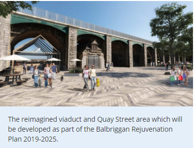
Imagine the Possibilities for our town
An initial €10 million rejuvenation scheme represents the start of Our Balbriggan - a three-year vision for the future of the town which you can help shape over the next few weeks.
Reference: https://balbriggan.ie/
V.Attractions
1, Ardgillan Castle
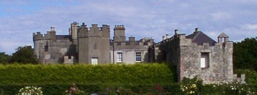
View of Ardgillan Castle from the gardens
Ardgillan Castle is a country house near Balbriggan, County Dublin, Ireland. It is set in the 200-acre (0.81 km2) Ardgillan Demesne, a public park in the jurisdiction of Fingal County Council.
2, Skerries South Beach
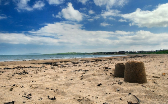
3, Colt Island
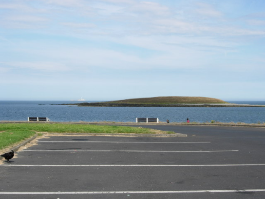
Colt Island is the closest and smallest of three low-lying, uninhabited islands off the headland of Skerries, Fingal, County Dublin in Ireland.
Toponymy
The origin of the original, Irish, name is unknown although it has been proposed to be related to a food source. The anglicised version of the name cannot be a translation as the Irish word for a colt is bromach.
Environment
It is an island of low cliffs and lies about 0.5 km from the mainland, with vegetation consisting of grasses, brambles and other species such as hogweed. Like the other two Skerries Islands, it is important for breeding seabirds and wintering water fowl.
4, FourKnocks Tomb
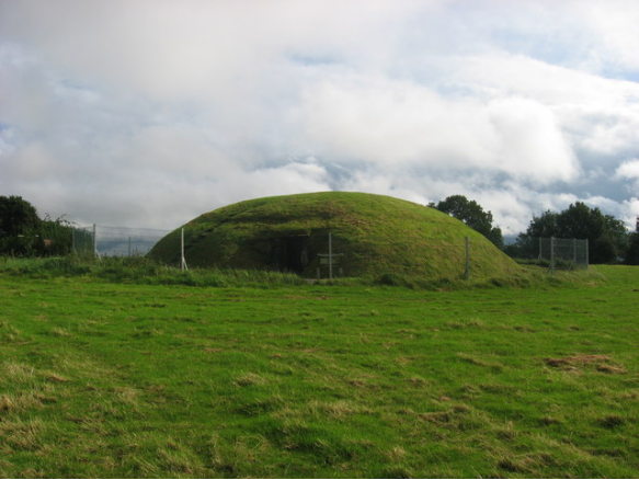
Tomb, prehistory, and archaeological excavation
Fourknocks Passage Tomb is a passage grave and National Monument located in County Meath, Ireland.
Location
is located 2.7 km (1.7 mi) northwest of Naul, near a hilltop overlooking the Delvin River. The placename means either "cold hill" or "bare/exposed hill."
History
Fourknocks Passage Tomb dates to 3000–2500 BC.
It was unknown to archaeology until 1949, when a woman making a visit to Newgrange mentioned, "there are mounds like this on my uncle’s farm." It is not marked on any of the old Ordnance Survey maps. It was first excavated in 1950-52 by PJ Hartnett. He found cists, grave goods including a foot bowl and a carved antler pin, urns containing cremated remains and a posthole. Unlike other passage graves, the tomb at Fourknocks is not believed to have been covered over with stones. A wooden pole may have held up a wooden or animal-skin roof.
During reconstruction after excavation, a concrete roof was placed over the chamber for protection.
Description
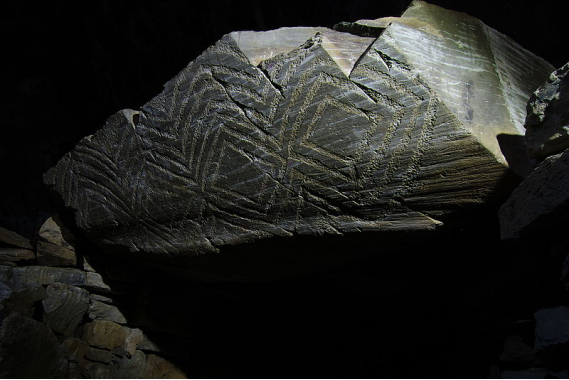
Southern lintel.
Fourknocks has a short passage leading into a wide, pear-shaped chamber with three smaller offset chambers. The original roof was likely a wooden structure supported by a central pole.
Two of the lintels have chevron decoration and one of them has lozenge decoration.
Two other mounds in the Fourknocks complex were excavated. One of these likely served as the cremation site for the bones found in the main tomb and was used for later interments.
5, Baldongan Church
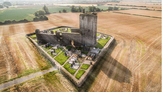
Baldongan Church, also called Baldungan Castle, is an ancient ruined church and National Monument near Skerries, County Dublin, Ireland.
Location
Baldongan Church lies in a rural part of north County Dublin (modern County Fingal), halfway between Skerries and Lusk and 2.4 km (1.5 mi) from the seashore.
6, St. Patrick's Island
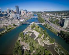
St. Patrick's Island Park (also simply known as St. Patrick's Island) is a 31-acre public park on an island at the confluence of the Bow and Elbow rivers just northeast of Downtown Calgary. St. Patrick's Island is one of Calgary's oldest parks. Its development as a public space began in the 1890s, gaining momentum as an important public space in the Calgary inner city with the construction of a bridge to the island in the early 1900s. Throughout the decades, the island has been transformed, playing host to a campground in the 1960s, to being the host of squatters for much of the period from the 1980s to the 2000s. For several decades, the island was connected to Calgary's undesirable East Village neighbourhood by a steel and wooden bridge. However, in the late 2000s the Calgary Municipal Land Corporation began a redevelopment of the East Village, with a particular focus on redeveloping St. Patrick's Island into a full-fledged city park with programmed activities and physical access to the Bow River. After years of construction, the newly redeveloped St. Patrick's Island Park opened to the public in July 2015, along with the new George C. King Bridge which connects the island park with both the East Village to the south and Bridgeland to the north.
7, Delvin River
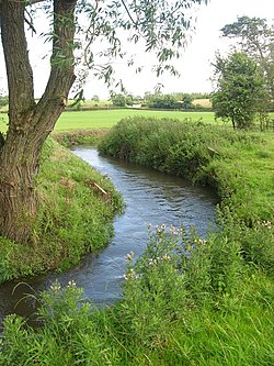
The River Delvin (Irish: An Ailbhine) is a river of northern County Dublin, about 18 kilometres (11 mi) long and forming much of the Dublin-Meath boundary; it is thus largely under the responsibility of Fingal County Council, sometimes shared with Meath County Council.
Name
Delvin or An Ailbhine is derived from Old Irish ailbine, possibly from ollbine, that is "great crime." The river is also sometimes known as the Elvene, Elvin Water, Elvin or Delvyn.
VI.History
There is no consensus about when the foundation of the town occurred, other than there may always have been a small settlement of fishermen, weavers and some sort of agricultural trade post.
18th century
An 18th century traveller described Balbriggan as "... a small village situated in a small glin [glen] where the sea forms a little harbour – it is reckoned safe and is sheltered by a good pier. The village is resorted to in Summer time by several genteel people for the benefit of bathing."[citation needed]
Balbriggan rose from a small fishing village to a place of manufacturing and commercial importance in part due to local landowner and judge George Hamilton, Baron of the Court of Exchequer (Ireland), who, in 1780, established factories to aid in the manufacturing of cotton.He also improved the harbour by building the pier, which was completed in 1763.
19th century
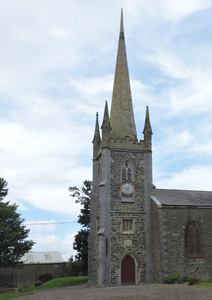
St. Georges Church tower, 1813
Lewis's Topographical Directory of Ireland, from 1837, refers to Balbriggan as follows:
A seaport, market and post village and a chapelry, in the parish and barony of Balrothery, county of Dublin, and province of Leinster, 15 miles (N. by E.) from Dublin; containing 3,016 inhabitants.
The inhabitants are partly employed in the fishery, but principally in the manufacture of cotton; there are two large factories, the machinery of which is worked by steam-engines and water-wheels of the aggregate power of 84 horses, giving motion to 7,500 spindles, and spinning upon the average about 7,400 lb (3,356.58 kg). of cotton yarn per week. More than 300 persons are employed in these factories, to which are attached blue dye-works ; and in the village and neighbourhood are 942 hand-looms employed in the weaving department. The principal articles made at present are checks, jeans, calicoes and fustians. The village is also celebrated for the manufacture of the finest cotton stockings, which has been carried on successfully since its first establishment about 40 years since; there are 60 frames employed in this trade, and the average produce is about 60 dozen per week. There are on the quay a large corn store belonging to Messrs. Frost & Co., of Chester, and some extensive salt-works; and in the village is a tanyard.
The fishery, since the withdrawing of the bounty, has very much diminished: there are at present only 10 wherries or small fishing boats belonging to the port. The village carries on a tolerably brisk coasting trade: in 1833, 134 coal vessels, of the aggregate burden of 11,566 tons, and 29 coasting vessels of 1,795 tons, entered inwards, and 17 coasters of 1,034 tons cleared outwards, from and to ports in Great Britain. The harbour is rendered safe for vessels of 150 tons' burden by an excellent pier, completed in 1763, principally by Baron Hamilton, aided by a parliamentary grant, and is a place of refuge for vessels of that burden at 3/4 tide. A jetty or pier, 420 feet (128 metres) long from the N. W. part of the harbour, with a curve of 105 feet (32 metres) in a western direction, forming an inner harbour in which at high tide is 14 feet (4 metres) of water, and affording complete shelter from all winds, was commenced in 1826 and completed in 1829, at an expense of £2,912–7s–9d, of which the late Fishery Board gave £1,569, the Marquess of Lansdowne £100, and the remainder was subscribed by the late Rev. Geo. Hamilton, proprietor of the village. At the end of the old pier there is a lighthouse.
The Drogheda or Grand Northern Trunk railway from Dublin, for which an act has been obtained, is intended to pass along the shore close to the village and to the east of the church. The market is on Monday, and is abundantly supplied with corn, of which great quantities are sent to Dublin and to Liverpool; and there is a market for provisions on Saturday. Fairs are held on the 29th of April and September, chiefly for cattle. A market-house was erected in 1811, partly by subscription and partly at the expense of the Hamilton family. The village is the headquarters of the constabulary police force of the county; and near it is a Martello tower with a coast guard station, which is one of the nine stations within the district of Swords. Petty sessions for the north-east division of the county are held here every alternate Tuesday.
The chapelry of St. George, Balbriggan, was founded by the late Rev. G. Hamilton, of Hampton Hall, who in 1813 granted some land and settled an endowment, under the 11th and 12th of Geo. III., for the establishment of a perpetual curacy; and an augmentation of £25 per annum has been recently granted by the Ecclesiastical Commissioners from Primate Boulter's fund. In 1816 a chapel was completed, at an expense of £3,018–2s–2d, of which £1,400 was given by the late Board of First Fruits, £478-15s–2d., was raised by voluntary subscriptions of the inhabitants and £1,139-7s–0d., was given by the founder and his family. This chapel, which was a handsome edifice with a square embattled tower, and contained monuments to the memory of R. Hamilton, Esq., and the Rev. G. Hamilton, was burned by accident in 1835, and the congregation assemble for divine service in a school-room until it shall be restored, for which purpose the Ecclesiastical Commissioners have lately granted £480. The living is in the patronage of G. A. Hamilton, Esq.
There is a chapel belonging to the R.C. Union or district of Balrothery and Balbriggan, also a place of worship for Wesleyan Methodists. A parochial school and dispensary are in the village.
Historical events
Medieval battle
According to Ware, a medieval annalist, a battle took place at Balbriggan on Whitsun-eve, 1329, between the combined forces of John de Bermingham, Earl of Louth (who had been elevated to the 'palatine dignity' of the county) and Richard, Lord of Malahide, and several of their kinsmen, and the forces of local rival families, the Verduns, Gernons and Savages, who were opposed to the elevation of the earl. In this event, the former, with 60 of their English followers, were killed.[citation needed]
William III
William III camped here after the Battle of the Boyne, in July 1690.
Milling
Balbriggan was the location of the 19th century Smith's Stocking Mill, which made stockings as well as men's "Long-Johns" called Balbriggans. These are often mentioned in John Wayne films – 'he put his balbriggans on' – and both Queen Victoria and the Czarina of Russia also wore "Balbriggans". Balbriggan's strong textile connections also include the linen & cotton manufacturing of Charles Gallen & Company, who in 1870, purchased the existing weaving mill and associated facilities built by Baron Hamilton. The firm became famous as the finest linen weavers in Ireland and had custom all over the world. They were also suppliers of linens to the Vatican, Embassies of Ireland and the US, and fine hotels worldwide. The business continues today from another location as the old mill in the town centre has been redeveloped.
Sack of Balbriggan
Main article: Sack of Balbriggan
The assault on the village's population by the British Black and Tans based in the nearby Gormanston military barracks on 20 September 1920 was one of the more infamous acts of the Irish War of Independence. This event, known as the "Sack of Balbriggan", resulted in the destruction of 54 houses and a hosiery factory, and the looting of four public houses. The attack received much international attention due to Balbriggan's position close to foreign news correspondents in Dublin. A subsequent delegation from the United States pledged to rebuild thirty homes in the village and a local factory. Other deaths followed during the war, most noticeably those of Séamus Lawless and Sean Gibbons who were bayoneted to death by the British forces on 21 September 1920. A plaque on Bridge Street in the town commemorates their murder.
Wavin
Wavin has been manufacturing plastic pipes, contributing to the provision of running water in many Irish rural homes, in their purpose-built facility since 1962.
VII.Other information
Etymology
According to P.W. Joyce, the name arises from Baile Breacain [sic], which literally means "Brecan's Town". Brecan is a common medieval first name and there are several other Brackenstowns in Ireland. There is also a possible link to the local Bracken River, in which case the name could derive from breicín, meaning "little trout".
Many locals however have traditionally felt that Baile Brigín means "Town of the Little Hills", due to the relatively low hills that surround the town.
The town's name could be derived from the word brecan, as the area was part of a Medieval kingdom known as Brega, populated by a tribe or clan known as the Bregii, and the aforementioned River Bracken.
Amenities
The town is coastal and has a sandy beach. It was at one time a holiday destination for people from Dublin city.
Balbriggan is also the location of a Sunshine Home which aims to provide a holiday to underprivileged children from the Greater Dublin area. The home is operated by the Sunshine Fund, a unique branch of the Society of Saint Vincent de Paul which provides week-long summer breaks for children aged 7 to 11 from disadvantaged parts of Dublin, Meath, Wicklow and Kildare. The purpose-built home has hosted these holidays since 1935, with over 100,000 young people having passed through their doors.
Buildings of note
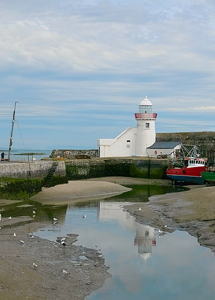
Balbriggan Lighthouse
-- Balbriggan Market House is a 5-bay two-storey building dating from 1811.
-- Balbriggan Carnegie Free Library, built c.1905.
-- National Irish Bank building, Drogheda Street, built c.1885.
-- Balbriggan Court House, built c.1844.
-- Balbriggan Railway Viaduct, built c.1843.
-- Loreto Convent, built c.1905
-- St. Peter and Paul's Church, built in 1842 (Gothic Revival style).
-- St. Georges Church, built in 1813 (Gothic Revival style).
-- Lighthouse, built in 1761 and listed in the National Inventory of Architectural Heritage (NIAH) with reg. nr.11305017.
-- Bremore Castle, built in 14th century and later deteriorated, it has been restored by the Parks -- Department of Fingal County Council and the Balbriggan and District Historical Society.
-- Balbriggan also has a Martello Tower which was built by the British during the Napoleonic Wars. It is one of 29 Martello towers in the Greater Dublin Area
Education
Secondary
There are five secondary schools in the town:
-- Ardgillan Community College (opened 2009)
-- Bremore Educate Together
-- Loreto Secondary Balbriggan
-- Balbriggan Community College.
-- Coláiste Ghlór na Mara, an Irish-language secondary school.
-- Ardgillan Community College was closed abruptly in October 2018 after adverse fire safety findings. Problems were identified, and are being found, are other schools built by the same Dungannon-based company, Western Building Systems.
Adult Education
Fingal Adult Education Service Fingal Adult Education Service offers numerous adult education courses both full and part-time.
Religion
Roman Catholic
Balbriggan is a parish in the Fingal North deanery of the Roman Catholic Archdiocese of Dublin. The parish church is the Church of Ss. Peter and Paul, with Mass available in English and Polish. This church features two stained glass windows by Harry Clarke.
Church of Ireland
In the Church of Ireland structure, Balbriggan forms part of a combined parish with Balrothery and Balscadden. The parish church, on Church St., is dedicated to St. George.
Baptist
There is a Baptist congregation that meets at premises on Hampton St.
Pentecostal
Pentecostal congregations meet at premises on Dublin Street and Hampton Street.
VIII.Contact information
Balbriggan Chamber of Commerce
T: 01 968 0080
E: info@balbrigganchamber.ie
www.balbrigganchamber.ie
Balbriggan Enterprise and Training Centre (BEaT Centre)
01 802 0400
info@beat.ie
www.beat.ie
Balbriggan Enterprise Development Group (Community Training & Enterpise)
01 802 0417
Website: https://balbriggan.ie/
Social Media:
Facebook: Our Balbriggan - Get Involved @ourbalbriggan
Twitter: Our Balbriggan@OurBalbriggan
Reference: https://balbriggan.ie/
