Longford, in the province of leinster, Ireland 作者: 来源: 发布时间:2021-04-12
I.Population and Area
Population in 2011:38,970
Population in 2016:40,873
Population Density: 39 people per square km(2011)
Total Area: 421.24 sq miles(1,091 km2)
II.Natural Geography (Environment, resource and transportation)
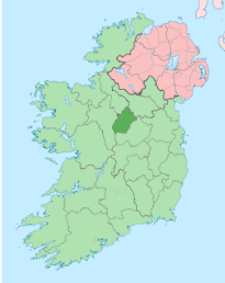
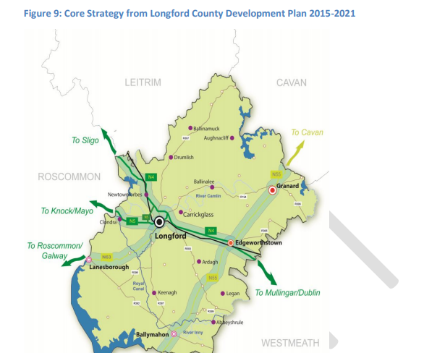
It is a landlocked county and is bordered by the counties of Cavan, Leitrim, Roscommon, and Westmeath.
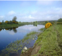
To the west, it is bordered by the Shannon. This is Ireland’s longest river and acts as a natural barrier between the west and east of the country. The other main river that flows through Longford is the Inny, which flows through Lough Sheelin, Lough Kinale and Lough Derragh along its course. The Royal Canal also passes through Longford.
Longford has a relatively low-lying countryside compared to other regions of Ireland and is characterised by lakes, bogland, wetland and pastureland to the south. The very northern region forms part of the drumlin belt that travels across much of the northern midlands. The highest point in the county is Carin Hill at just 278 metres but on a clear day the summit offers spectacular views to nine other counties. Its name derives from the ancient territory of this part of Longford, Clann Aodha, which was ruled over by the powerful O’Farrell family.
Situated on top of the hill are two cairns that are believed to be ancient passage tombs. According to legend, Cailleach a Bheara (an ancient Celtic witch) dropped stones from her apron as she flew over the hill, explaining the presence of these two great rocks. This is a common legend in Ireland where passage tombs occur.
Transportation:
Nearest major airport to Longford, Ireland: The closest major airport to Longford, Ireland is Ireland West Airport Knock (NOC / EIKN). This airport is in Charlestown, Ireland and is 84 km from the center of Longford, Ireland. If you're looking for international flights to NOC, check the airlines that fly to NOC.
Protrans International Transport is one of the largest Transport and Logistics operations in the Midland Region. Their base in the heart of Ireland allows them access to all parts of the country with easy access into Europe as well.
III.ECONOMY
IV.Industrial Characteristics:
1)Butler Manufacturing Services Ltd
Management in Longford, Construction in Longford, Processing in Longford, Industrial in Longford
BMS is a specialist designer and manufacturer of wastewater treatment products including sewage treatment products, silt traps, rainwater harvesters, surface water products, attenuation products, drainage pumps, sewage pumps, petrol interceptors, oil interceptors, grease traps, and car wash water recycling.
2)Leixlip construction Services
Industrial in Longford, Construction Services in Longford, Industrial Construction in Longford
V.Attractions
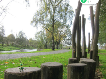
The Mall: Fantastic amenity in Longford town.....beautiful walk around the perimeter, including riverside walk;great swimming pool and gym; outdoor gym equipment along the walk; basketball courts....indoor and outdoor; duck pond; playgrounds; sports fields; beautiful trees, flowers, wild…
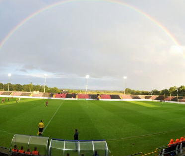
The home of LTFC is a fine facility they can be proud of. The surface of the pitch is top class and now have a second pitch along side.On match night tea,coffee sandwiches etc are on offer. The Main stand holds about 1200,the capacity of the ground is about 7000 seated.
VI.History
County Longford is named after the town of Longford and is located in the midlands of Ireland in the province of Leinster . Its Gaelic name is Longphort, signifying a fortress. Originally, Longford referred to old circular forts, later to the stone castles. There are about twenty places in Ireland called Longford, each named for fortresses of some kind. It is the fourth smallest county in Ireland. Its length is 30 ½ miles from the southwest point in Lough Ree near Black Islands, to the northeast conrner near Gulladoo Lough and its breath is 18 miles from the river Inny in the east to Drumshango Lake north of Drumlish. The area is 421.3 square miles (1,091.3 sq km).
County Longford was traditionally known as “Annaly” from the ninth to the fifteenth centuries. As a result of the Norman invasion in the twelfth century, it was given to Hugh de Lacy as part of the Liberty of Meath. Due to the power of the O’Farrells, the Norman influence was small. It was made a county in 1586 during the reign of Elizabeth I. English settlers were planted in Longford during the sixteenth and early seventeenth century. In 1641, the county became involved in the Catholic Confederacy, which was defeated by Cromwell in 1649. The Cromwellian plantations of the 1650 completed the control of the county. It was, however, also a center in the 1798 rebellion with the French forces being defeated outside the village of Ballinamuck by the English army.
In 1821, the County’s population was 107,570 and increased to 115,491 in 1841. During the Great Famine of 1845-1847, the population decreased until it was 82,348 in 1851. The population continued to decrease to 39,847 in 1926. In 2006, the population was 34,391. County Longford is predominately Roman Catholic. In 1891, the percentage of Roman Catholic, Church of Ireland, Presbyterian and Methodist was 91.3%, 7.7%, 0.5% and 0.4%. Overtime, the Roman Catholics have decreased slightly to 89.9% in 2002, while the Church of Ireland, Presbyterians and Methodists decreased to 3.3%, 0.3% and 0.3%, respectively, with other or no religions increasing to about 4.5%.
VII.Other information:
County Longford is bounded by Counties Leitrim (northwest), Cavan (northeast), Westmeath (southeast), and Roscommon (west). The main features of drainage are the valleys of the Rivers Shannon, Erne, and Inny and Loughs (Lakes) Gowna and Ree. The surface of the county, generally a part of lowland Ireland, rises from the Shannon to elevations of 200 to 400 feet (60 to 120 metres), but there are isolated hills and ranges. The lowland is thickly plastered with glacial drifts and has large areas of bog.
Most farms occupy less than 30 acres (12 hectares), and their main concern is the raising of cattle, chiefly for export to the richer and larger farms of Meath. Major crops include oats and potatoes. There is also some dairying. About one-fourth of the county’s population lives in towns, of which the largest is Longford.
Longford, whose early name was Annaly, or Anale, was a principality of the O’Farrells and was originally part of County Meath. In the 12th century it was granted by Henry II to Hugh de Lacy, who started an English colony there. On the division of Meath into two counties in 1543, Annaly was included in Westmeath. By 1569 it was a shire under the name of Longford. Area 421 square miles (1,091 square km). Pop. (2002) 31,068; (2011) 39,000.
VIII.Contact information
-Mayor
Joe Flaherty
Great Water St. Longford N39 NH56
Tel:043-3343300
Emergency out of hours:(1850)211525
Email:info@longfordcoco.ie
Reference website: http://www.longfordcoco.ie/search?q=mayor%27s+name
