Port Fairy, Victoria 作者: 来源: 发布时间:2021-06-04
I. Population and Area
Total Area: 0.31 km²
Population: 3, 094
https://localstats.com.au/demographics/vic/south-western-victoria/great-ocean-rd-otway-ranges/port-fairy
II. Natural Geography
-Climate
Weather in January
January in Port Fairy, Australia, is a moderately hot summer month, with temperature in the range of an average high of 24°C (75.2°F) and an average low of 13°C (55.4°F). In January, the average high-temperature is essentially the same as in December - a warm 24°C (75.2°F).
Weather in February
February, the last month of the summer, in Port Fairy, is another warm month, with average temperature varying between 13°C (55.4°F) and 25°C (77°F). With an average high-temperature of 25°C (77°F) and an average low-temperature of 13°C (55.4°F), February is the warmest month.
Weather in March
The first month of the autumn, March, is also a moderately hot month in Port Fairy, Australia, with average temperature varying between 12°C (53.6°F) and 23°C (73.4°F). In March, the average high-temperature is essentially the same as in February - a still warm 23°C (73.4°F).
Weather in April
April, like March, is an agreeable autumn month in Port Fairy, Australia, with average temperature ranging between max 20°C (68°F) and min 11°C (51.8°F). In Port Fairy, Australia, the average high-temperature slightly decreases, from a warm 23°C (73.4°F) in March, to a pleasant 20°C (68°F).
Weather in May
May, the last month of the autumn, in Port Fairy, is another comfortable month, with average temperature ranging between max 16°C (60.8°F) and min 9°C (48.2°F). In Port Fairy, the average high-temperature marginally drops, from a pleasant 20°C (68°F) in April, to an enjoyable 16°C (60.8°F).
Weather in June
The first month of the winter, June, is still a mild month in Port Fairy, Australia, with average temperature varying between 7°C (44.6°F) and 14°C (57.2°F). June through August, with an average high-temperature of 14°C (57.2°F), are the coldest months.
Weather in July
July, the same as June, in Port Fairy, Australia, is a moderate winter month, with average temperature ranging between max 14°C (57.2°F) and min 6°C (42.8°F). June through August, with an average high-temperature of 14°C (57.2°F), are the coldest months.
Weather in August
August, the last month of the winter, in Port Fairy, is also a moderate month, with average temperature fluctuating between 14°C (57.2°F) and 7°C (44.6°F). June through August, with an average high-temperature of 14°C (57.2°F), are the coldest months.
Weather in September
The first month of the spring, September, is a comfortable month in Port Fairy, Australia, with average temperature ranging between max 16°C (60.8°F) and min 7°C (44.6°F). In September, the average high-temperature is almost the same as in August - an enjoyable 16°C (60.8°F).
Weather in October
October, the same as September, is another enjoyable spring month in Port Fairy, Australia, with average temperature fluctuating between 9°C (48.2°F) and 18°C (64.4°F). In Port Fairy, the average high-temperature is relatively the same as in September - a still comfortable 18°C (64.4°F). Weather in October »
Weather in November
The last month of the spring, November, is an agreeable month in Port Fairy, Australia, with temperature in the range of an average low of 10°C (50°F) and an average high of 20°C (68°F). In November, the average high-temperature is almost the same as in October - a pleasant 20°C (68°F).
Weather in December
The first month of the summer, December, is also an agreeable month in Port Fairy, Australia, with average temperature fluctuating between 22°C (71.6°F) and 11°C (51.8°F). In December, the average high-temperature is relatively the same as in November - a still agreeable 22°C (71.6°F).
https://www.weather-atlas.com/en/australia/port-fairy-climate
-Geography
The main focal point of Port Fairy is the Moyne River as it approaches the coast. The Fishermans Wharf area along the river is lined with boats and fishing craft, and good views of river activity can be enjoyed from the footbridge over the Moyne. Another good viewing spot is from the historic fortifications at Battery Hill which is located the southern end of Griffiths Street. Views can be enjoyed over the Moyne River and to the ocean.
Griffiths Island is situated at the mouth of the Moyne River and is linked to the coast via a pedestrian causeway. The island is home to a large colony of mutton birds, while at the eastern end of the island is the Port Fairy Lighthouse. A walking track circumnavigates the island.
Port Fairy features three main beach areas. Along Ocean Drive and fronting the Southern Ocean are pockets of sandy beaches, while running parallel to the Moyne River and accessed via Beach Street is the patrolled surf beach which faces Port Fairy Bay. Secluded beaches can also be found on Griffiths Island.
https://www.travelvictoria.com.au/portfairy/
Port Fairy is a coastal town in south-western Victoria, Australia. It lies on the Princes Highway in the Shire of Moyne, 28 kilometres (17 mi) west of Warrnambool and 290 kilometres (180 mi) west of Melbourne, at the point where the Moyne River enters the Southern Ocean.
https://moovitapp.com/index/en-gb/public_transportation-Port_Fairy-Melbourne-site_7136729-2803
-Transportation
Public Transportation to Port Fairy in Port Fairy
Wondering how to get to Port Fairy in Port Fairy, Australia? Moovit helps you find the best way to get to Port Fairy with step-by-step directions from the nearest public transit station.
Moovit provides free maps and live directions to help you navigate through your city. View schedules, routes, timetables, and find out how long does it take to get to Port Fairy in real time.
You can get to Port Fairy by Bus, Train or Tram. These are the lines and routes that have stops nearby -
Bus: 8, MELBOURNE - MOUNT GAMBIER VIA GEELONG & WARRNAMBOOL
Want to see if there’s another route that gets you there at an earlier time? Moovit helps you find alternative routes or times. Get directions from and directions to Port Fairy easily from the Moovit App or Website.
We make riding to Port Fairy easy, which is why over 840 million users, including users in Port Fairy, trust Moovit as the best app for public transit. You don’t need to download an individual bus app or train app, Moovit is your all-in-one transit app that helps you find the best bus time or train time available.
https://moovitapp.com/index/en-gb/public_transportation-Port_Fairy-Melbourne-site_7136729-2803
PTV Regional Bus
The first stop of the 8 bus route is Koroit Street Interchange/Koroit St (Warrnambool) and the last stop is Port Fairy Visitor Centre/Bank St (Port Fairy). 8 (Direction: Port Fairy) is operational during everyday.
Additional information: 8 has 19 stops and the total trip duration for this route is approximately 42 minutes.
On the go? See why over 840 million users trust Moovit as the best public transit app. Moovit gives you PTV Regional Bus suggested routes, real-time bus tracker, live directions, line route maps in Melbourne, and helps to find the closest 8 bus stops near you. No internet available? Download an offline PDF map and bus timetable for the 8 bus to take on your trip.
https://moovitapp.com/index/en-gb/public_transportation-line-8-Melbourne-2803-906711-492245-0
III. Economy

https://quickstats.censusdata.abs.gov.au/census_services/getproduct/census/2016/quickstat/SSC22093
IV. Industrial Characteristics
Port Fairy, town, Victoria, Australia. It lies at the mouth of the Moyne River, on a headland east of Portland Bay (an inlet of the Indian Ocean). A settlement established there in 1835 was called Belfast for a time until it was renamed for a ship, the Fairy, that had sheltered in its harbour in 1810. Port Fairy became Victoria’s first municipality (1852) and was proclaimed a borough in 1863. Connected to Melbourne (150 miles [240 km] northeast) and Adelaide by road and rail, it is a regional agricultural centre (sheep, cattle, dairying, and vegetable farming). Industries include engineering, food processing, and the production of bluestone products and antibiotics. Port Fairy is also a resort, and its harbour, which served as a whaling station in the 19th century, is now the base of a large fishing fleet. Nearby are Battery Hill (an old fort), the extinct volcanoes Tower Hill and Mount Eccles, and seal and muttonbird rookeries. The Port Fairy Folk Festival attracts thousands of music lovers every March during the Labour Day long weekend. Pop. (2001) urban centre, 2,523; (2011) urban centre, 2,833.
https://www.britannica.com/place/Port-Fairy
Key Projects:
Port Fairy
Assessing the impacts of climate change on Port Phillip Bay coastline
A new Victorian Government funded project will assess the environmental effects of climate change along the Port Phillip Bay coastline, to help land managers understand the hazards they may face in future.
Led by CSIRO, the project will assess the extent of three key coastal hazards - inundation, coastal erosion, and groundwater change – under several climate change scenarios.
Department of Environment, Land, Water and Planning (DELWP) Project Manager, Dr Tamara van Polanen Petel said: “This project is an important piece of the puzzle in understanding what climate change means for Victoria’s natural and built environments.”
“We know that climate change is happening, and we know that it can create coastal hazards. What we don’t currently understand is the extent of those hazards and the kind of impacts we will see along the coastline,” Dr Petel said.
“Impacts such as roads flooding, beaches and cliffs eroding and inland waters becoming saltier may occur as a result of climate change.
“It’s important that this modelling work happens so that land managers, including government departments and councils, can consider how best to plan for, build and manage coastal areas in the years to come.”
The Port Phillip Bay Coastal Hazard Assessment is the fifth assessment of its kind in Victoria, with similar studies being completed for Westernport Bay, Port Fairy, Bellarine/Corio Bay and Gippsland Lakes/90 Mile Beach
To undertake the assessment, CSIRO will draw on myriad data from across government, industry and research sectors. The assessment will be completed in early 2020.
DELWP is working closely with 10 bay-area councils, Parks Victoria, Melbourne Water, the two Catchment Management Authorities on the Bay, the Association of Bayside Municipalities and Traditional Owners.
https://www.delwp.vic.gov.au/media-centre/media-releases/assessing-the-impacts-of-climate-change-on-port-phillip-bay-coastline
V. Attractions
Explore Port Fairy and surrounds diverse natural attractions. Including riverside parks, picturesque botanical gardens and scenic coastline - perfect for winter whale watching. Take the trail beyond Port Fairy to discover an idyllic escape to nature and even more Great Ocean Road natural wonders. Experience a rich cultural landscape formed by powerful ancestral creation forces. Eyeball native wildlife in natural habitats: kangaroos, emus, koalas, kookaburras and shorebirds. Let a magical day unfold in Aussie bushland with a waterfall backdrop. Marvel at Australia’s largest population of hooded plovers or a thousands-strong flock of shearwaters returning to their island home at dusk. Forest get-aways, secluded coves, ocean adventures, picnic perfection and everyday surprises – there’s inspiration for everyone along Moyne’s Big Nature Trail.
Budj Bim National Park
Budj Bim National Park is only a five minute drive west of Macarthur via a sealed. Geologists estimate that Budj Bim first erupted around 30,000 years ago, producing a river of hot molten lava that flowed around 50km south to the sea. This lava flow effectively dammed rivers and streams forming large wetlands and swamps. Budj Bim National park features several walking tracks, a camping area and excellent picnic facilities. The geological features include Lake Surprise, a beautiful crater lake, lava canals, a natural bridge, lava blisters, collapsed lava tunnels and lava cake (take a torch). The park also contains Victoria's last great stand of manna gum woodland, the favourite food of the resident koala population.
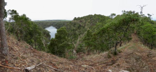
Tower Hill
Tower Hill State Game Reserve to the east of Port Fairy is a rare example of a nested maar volcano, and was declared Victoria's first National Park in 1892. Local animals and plant species are in abundance however it wasn't always like this. Following European settlements of the western district land was cleared for farming purposes and the area became quite degraded and barren. In the 1960s groups of people including field naturalists, school children, sporting shooters and many others began to restore the landscape. Overtime as the trees and shrubs matured, birds and animals returned to Tower Hill. Picnic facilities, an interpretive centre, tours and walking trails make this a "must do" activity.
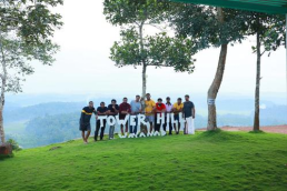
Griffiths Island
A natural oasis almost in the heart of the town, Griffiths Island supports a number of native animals including a small mob of swamp wallabies. It is also the site of one of Australia's most accessible breeding colonies of short tailed shearwaters or mutton-birds. Griffiths Island is very popular for bird watching from September through to April.
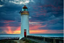
The Crags
A short drive west of Port Fairy you will find The Crags. Crags is a wild and scenic section of the coastline with calcified tree roots, jagged outcrops and panoramic views along the coast. The rocky cliffs protect small bays and are rich in wildlife including significant Silver Gull breeding site on the eastern most island. you can view the whole reserve from the lookout including Lady Julia Percy Island offshore.
The are contains many aboriginal cultural sites and places and has spiritual connections with Lady Julia Percy Island. The Crags was used over many thousand of years as a gathering, ceremonial and feasting place for Aboriginal people. Its cultural significance is listed un the National Estate of Australia.
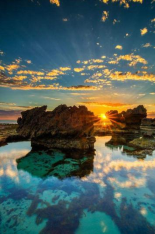
Belfast Coastal Reserve
Belfast Coastal Reserve Stretching from Warrnambool to Port Fairy comprises rocky reefs, sandy beaches, coastal dunes, salt marshes, estuaries and endangered animals such as the Orange-bellied Parrot. The area is also a home to Victoria's largest population of Hooded Plovers, and southern right whales and dolphins may appear in the reserve's waters. Belfast Coastal Reserve is a great place for walking along the beach, swimming, surfing, kite boarding, fishing, snorkelling, horse riding and bird watching.
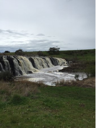
Hopkins Falls
The Hopkins River meanders through the Moyne Shire until it reaches Wangoom where it plunges down a rocky escarpment before making its way to the sea at Warrnambool. A viewing platform offers fantastic viewing and photo opportunities. There are picnic facilities in the reserve. Best times for viewing the falls are winter and spring when rainfall is usually at its peak.
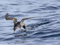
Mutton Birds
The bird we commonly call the mutton-bird is the short tailed shearwater (Puffinus tenuirostris). It was given the name by the early settlers who utilised its fatty flesh for food and as a source of oil. Today the bird is totally protected in Victoria, although limited harvesting still occurs in some Tasmanian islands. The short-tailed shearwater is the only variety of petrel whose breeding ground lies solely in Australia, mostly on islands off south-eats Australia concentrated around Bass Strait. The birds appear in large numbers and the Griffiths Island colony numbers several thousand birds.
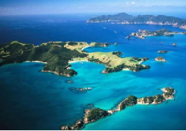
Bay of Islands
Pounded by wild seas and fierce winds, the coast of the Bay of Islands Coastal Park has been sculpted over thousands of years to become one of the most impressive natural sites in Australia. Towering rock stacks, arches and islands have been carved out of the soft cliffs by rain, wind and ocean waves. The pale limestone of this section of coast reflects a different quality of light and offers superior photographic opportunity in overcast conditions. Highly underrated!
Childers Cove
Around 20 kms from Warrnambool, at the western end of the 12 Apostles coastline. A beautiful small beach with a bluff crossing the western end of the beach. The beach is low and flat, with a shallow bay floor. Easy access to these stunning coves rewards you with large sea and surf, sandstone stacks and colorful sandstone/limestone cliffs, walking these beaches is one of those rare experiences of seclusion mixed with awe of the forces of nature. The name comes from wreck of “The Children” in 1839 in which 17 perished.
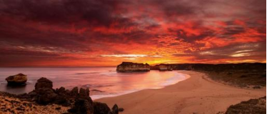
Ralph Illidge Sanctuary
The Ralph Illidge Sanctuary is a peaceful, relaxed and scenic reserve which is a safe haven for a variety of animals, flora and fauna.
Just 25 minutes drive east of Warrnambool, or less than an hour from Port Fairy, the sanctuary is easily found off the Warrnambool -Cobden Road.
Visitors are able to enjoy the native wildlife, many walking tracks, visit the information centre or have a picnic or barbecue (shelters, tables and gas barbecues are provided).
Koroit Botanic Gardens
Relax, enjoy a picnic and the playground at the lovely Koroit Botanic Gardens, designed by renowned landscape gardener and horticulturalist William Guilfoyle. The gardens were established in 1862 and form part of a large central recreational area. Located in High Street, the gardens cover about three hectares. Koroit's War Memorial is located on the edge of the Botanic Gardens.
Address: High Street, Koroit
Lady Julia Percy Island
West of Port Fairy, Lady Julia Percy island is Australia's only submarine volcano. When lava erupts under water a typical type of lava called pillow lava occurs. These are tube like structures where the interaction with water forms a crust on the outside and molten lava continues to flow inside. This island is home to the largest colony of fur seals in the Southern Hemisphere and several bird species. These include diving petrel, peregrine falcon, fairy prion and sooty oyster catchers. A number of small but unusual plant species survive in the caves in the cliff walls.
Tours are available - visit the Tourist Information Centre for more details.
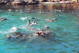
Kanawinka Geotrail
Kanawinka Geotrail, a region of amazing geological diversity stretching from Colac (on the Princes Highway 200 kilometres from Melbourne) to Millicent, in south-east South Australia. It is Australia’s first global geopark (a global geopark is an area with at least one site of scientific significance).
Volcanic activity is obvious throughout much of the Shire. In Port Fairy basalt boulders line the southern shoreline and have created sand fringed lagoons and bays. Many historic buildings throughout the area have been built using local basalt, which – when cut and dressed for building purposes – is called bluestone.
Port Fairy's Botanic Gardens
Established in 1859, Port Fairy’s Botanic Gardens were once described as “the handsomest of any provincial town”. Still picturesque, the gardens have been drastically reduced in size. The first plants and seeds were supplied by Ferdinand von Mueller, the director of the Melbourne Botanic Gardens and a noted botanist, and GW Francis, curator of the Adelaide Botanic Gardens, while a $5000 government grant enabled the erection of gates and fences.
Address: Griffiths Street, Port Fairy
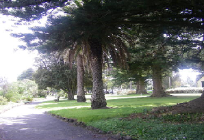
Martins Point
Fishermen and families love to take some time out at the wonderful Martins Point. Established on reclaimed land at the mouth of the river some time about a century ago, Martins Point offers shady trees, picnic tables, free barbecues, toilets, wide open space and a great children’s playground. Martin’s Point is a must do on any visit to Port Fairy.
Address: Gipps Street, Port Fairy
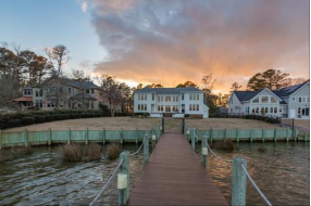
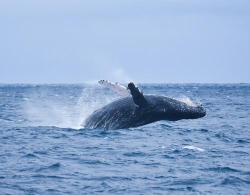
Whales in Winter
Whales can be seen in increasing numbers off the beaches in Port Fairy each year from June to October. The most commonly seen is the Southern Right Whale which comes into the area to mate and calve.They can be spotted nursing their young, waving their pectoral fins in the air and breaching - leaping head first out of the water and falling back with a mighty splash.
For more information contact the Port Fairy and Region Visitor Information Centre on 03 5568 2682
https://www.portfairyaustralia.com.au/natural-attractions/
VI. History and Culture
Port Fairy is a historic fishing town located on Victoria's far south-west coast on the Moyne river, between Portland and Warrnambool.
Many of Port Fairy's early buildings remain from its days as a port for sealers and whalers back in the 1800s, and many of those buildings can be viewed in the town's commercial centre along Bank Street and Sackville Street. Port Fairy is home to Victoria's oldest licensed hotel, the Caledonian Inn, which dates back to 1844.
https://www.travelvictoria.com.au/portfairy/
Art & Culture
Apart from a rich history, Port Fairy is also passionate about art and culture. They have shops for antiques, wood arts, paintings, crafts, and miscellaneous things like perfume bottles. The following are shops that can be found in Port Fairy:
Lowenthal Auctions
Periwinkle Antiques
Heather Wood
Brian Dunlop
Port Fairy Men’s Shed
Andrea’s Collection
Food & Wine Experiences
Fall in love with Port Fairy for its exquisite food and wine choices. Grab some snacks and just chill at the bar. Featured wines are as follows: Riesling, Pinot Noir, Henty Pinot Gris, Merlot, Shiraz, and a whole lot more! Care for an Irish pub theme? Port Fairy also has that!
Festivals
What would be the World’s Most Liveable Community if there were no festivals? Festivals make a place meaningful and colorful. Port Fairy’s culture includes festivities that you’ll want to experience.
Moyneyana Festival
This is the most wonderous festival in Port Fairy, as it offers free entertainment and enjoyable activities in town! This festival usually runs for about a month.
Port Fairy Jazz Festival
This jazz festival is run by volunteers. They provide ten different venues, including a few for dancing. This event is closed with a Sunday morning gospel service.
Koroit Irish Festival
As the name implies, the Koroit Irish Festival commemorates Port Fairy’s Irish history.
http://www.visitportfairy-moyneshire.com.au/about-port-fairy/#:~:text=Apart%20from%20a%20rich%20history%2C%20Port%20Fairy%20is,Port%20Fairy%3A%20Lowenthal%20Auctions.%20Periwinkle%20Antiques.%20Heather%20Wood.
VII. Contact Information
Cr Daniel Meade (Mayor)
Telephone:0417 896 138
Email:daniel.meade@moyne.vic.gov.au
Cr Colin Ryan (Deputy Mayor)
Telephone: 0418 455 625
Alternate Phone
03 5569 2456
Email:cryan@moyne.vic.gov.au
Moyne Shire Council
Princes Street, Port Fairy, Victoria 3284
Tel: +61 3 5568 0555
Fax: +61 3 5568 2515
PO Box 51, Princes Street, Port Fairy, Victoria 3284
http://www.moyne.vic.gov.au/Your-Council/Council-and-Councillors/Councillors
