Ocotlán, Jalisco 作者: 来源: 发布时间:2021-11-18
1.Population and Area
Pop: 89,340 (city)
Area: 247.7 km2 (munip.)
Elev: 1530 masl
2. Natural geography
Nature and weather
Geology
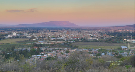
The city has quaternary land, composed of alluvial soil, residual soil, lake soil, sedimentary rock, sandstone-tuff and sandstone-conglomerate. The land where the city of Ocotlán sits is an alluvial plain with a small area of sandstone-type sedimentary rock located to the north. Likewise, in the neighboring hills that border the plains, there are igneous basalt-type rocks, in which geological faults and fractures are detected. In addition, places for the extraction of material to manufacture brick were found within the urban area.
Most of the city is flat, there are some hills and slopes; and a small part of rugged lands, hills with forests. The city of Ocotlán is located on flat lands, with slopes of less than 5%, which is why it presents favorable conditions for urban development, with the exception of some areas that, due to poor natural drainage, are susceptible to flooding. The abrupt topography with slopes greater than 15% is located to the north and southeast of the application area, corresponding to the Mesa de los Ocotes and Cerro El Gomeño elevations. The main height of the municipality is the Mesa de Los Ocotes, located north of the municipal seat, with a height of 1,830 meters. It is followed in importance by Cerro La Luz, located northwest of the municipal seat, with a height of 1,790 meters above sea level.
Hydrography
Lake Chapala acts as a climate regulator in Ocotlán, given its proximity to the city, 2,500 meters, and it is also a refuge for waterfowl, a source of fishing resources, income from tourism and water supply to Guadalajara. It can be considered as an area susceptible to an ecological prevention decree of state interest because it is outside the municipal limits.
The area of the municipality belongs to the great Lerma-Chapala-Santiago basin, the Lerma-Santiago hydrological region where the Zula river and the Santiago river are located, which is born in Lake Chapala and is the axis of the great basin and boundary intermunicipal. As for the Zula River, it collects most of the runoff from the area and the city, running from northeast to southwest and crossing Ocotlán to pay tribute to Santiago. The watershed between the Zula and Santiago basins passes through the city, thus causing the lands east of Santiago to discharge into the Zula River. In addition, three dams are located northeast of the area and seasonal runoff in it.
Flora and fauna
In the municipality the species that make up the flora are: pine, oak, eucalyptus, mesquite, pitahayo, nopal, huizache, guamúchil, sauz and sabino.
In the municipal head, the original vegetation has almost completely disappeared on the flat lands, and only a little of it is preserved in the Mesa de Los Ocotes and El Gomeño hills, which consists of "natural oak forests" in its peaks and "subinerme scrub", on its slopes, with natural and induced pastures. The envelope of the urban area, corresponding to flat land, is used in agricultural and livestock activities, with seasonal crops and irrigation. Manifestations of "gallery vegetation" are also detected in some riverbanks.
For what corresponds to the fauna of the municipality, there are species such as: deer, wildcat, squirrel, skunk, rabbit, armadillo, hare, coyote and various birds.
Köppen Classification: Mediterranean Climate
Under the Köppen Climate Classification climate classification, "dry-summer subtropical" climates are often referred to as "Mediterranean". This climate zone has an an average temperature above 10°C (50°F) in their warmest months, and an average in the coldest between 18 to -3°C (64 to 27°F). Summers tend to be dry with less than one-third that of the wettest winter month, and with less than 30mm (1.18 in) of precipitation in a summer month. SMany of the regions with Mediterranean climates have relatively mild winters and very warm summers.
The Köppen Climate Classification subtype for this climate is "Csb". (Mediterran Climate).
The average temperature for the year in Ocotlán - Lázaro Cárdenas is 68.0°F (20°C). The warmest month, on average, is May with an average temperature of 74.1°F (23.4°C). The coolest month on average is January, with an average temperature of 60.6°F (15.9°C).
The highest recorded temperature in Ocotlán - Lázaro Cárdenas is 103.1°F (39.5°C), which was recorded in September. The lowest recorded temperature in Ocotlán - Lázaro Cárdenas is 30.2°F (-1°C), which was recorded in December.
The average amount of precipitation for the year in Ocotlán - Lázaro Cárdenas is 35.4" (899.2 mm). The month with the most precipitation on average is July with 9.4" (238.8 mm) of precipitation. The month with the least precipitation on average is March with an average of 0.1" (2.5 mm). In terms of liquid precipitation, there are an average of 76.4 days of rain, with the most rain occurring in July with 18.4 days of rain, and the least rain occurring in March with 0.5 days of rain.
http://www.weatherbase.com/weather/weather.php3?s=914047&cityname=Ocotl%E1n--L%E1zaro-C%E1rdenas-Jalisco-Mexico
Getting there and around
Get there
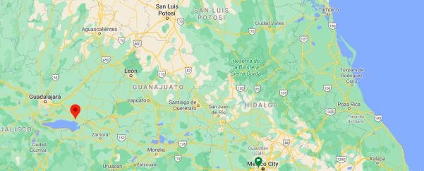
By plane – The quickest flight from Mexico City Airport to Guadalajara Airport is the direct flight which takes 1h 15m. From there, you can take a bus or drive to Ocotlán. Driving from Guadalajara to Ocotlán takes around 1h 45m.
By car – The quickest way to get from Mexico City to Ocotlán is to drive which costs $800 - $1200, including tollbooths, and takes 4h 56m. The distance between Mexico City and Ocotlán is 395 km. The road distance is 465.4 km.
By bus – The cheapest way to get from Mexico City to Ocotlán is to bus via Izazaga which costs $650 - $1500. there are services departing from Izazaga and arriving at Ocotlán via Mexico City North and Guadalajara. The journey, including transfers, takes approximately 9h 16m.
https://www.rome2rio.com/s/Mexico-City/Ocotl%C3%A1n
Rideshare – Check out Blabla Car's carpooling service for rideshare options between Mexico City and the city you are visiting. A great option if you don't have a driver's license or want to avoid public transport.
Car Rental – To explore Mexico’s provincial towns and cities—including its beach locations and the scenery and attractions near them— consider renting a car for your visit. Having your own car will give you more flexibility than using public transport options and, in some cases, offer you access to places which are otherwise difficult to visit without the use of a car.
COVID19 – International entry into Mexico from United States
Allowed for: All visitors arriving by air. Mexico land borders are closed to non-essential travel
Restricted for: There are no current restrictions.
Get around
Local Buses – Local buses and mini-buses (combis or micros) are available locally for a fraction of the cost of a taxi around town. You need to speak Spanish to be able to ask for directions or ask the driver to tell you where to get off.
Taxis – Taxis in most of Mexico’s towns and cities are not metered, so agree your price before you get in. Taxi travel is very affordable in Mexico, in comparison to the USA, Canada and Europe, and so provides a viable means of public transportation in Mexico. Your hotel can arrange taxis for you; some post their rates on a board in the lobby; taxi hotel rates are usually higher than cabs you hail off the street. If you speak Spanish, you will have a distinct advantage and be able to negotiate a price with the driver.
Uber is expanding rapidly across Mexico and now offers services in cities across the country, including: Mexico City, Toluca, Cuernavaca, Puebla, Querétaro, León, Aguascalientes, San Luis Potosí, Guadalajara, Monterrey, Hermosillo, Tijuana, Mexicali, and Mérida. Uber has been adding Mexican cities to its network every year, check for availability when you arrive at your destination in Mexico.
Cabify and Didi are also developing and currently operate in cities including Mexico City, Toluca, Monterrey, Puebla, Querétaro and Tijuana. Check for availability in the city you are visiting.
These services offer people with smartphones a way to book a cab through a mobile app for a pre-agreed price. Fares are comparable with Sitio type cabs, and sometimes trade at a premium to this when local demand increases.
https://www.mexperience.com/transport/taxi-travel-in-mexico/#51
3. ECONOMY
GDP: 18,692 M MXN (2010, Salina Cruz-Santo Domingo Tehuantepec metro area)
https://imco.org.mx/ciudades2010/ciudades/32_Tehuantepec.html
4. Industry characteristics
The furniture industry in Ocotlán began in the sixties with the mass production of wooden furniture and derivatives, the first furniture maker being Mr. Jesús Chavoya Salcedo. This activity began to consolidate during the eighties, but it was not until the nineties that the number of companies engaged in the manufacture of furniture doubled. For more than 10 years, this has been the main industrial activity in Ocotlán, an activity that has become one of the most solid pillars of the economy of the municipality and of the Cienega region.
Key project: Ocotlán Regional Hospital
Although it had been announced that the Ocotlán Regional Hospital would be built in the unfinished facilities of the penitentiary that are heading to the Xoconostle community, this proved unfeasible, so it will be built on land behind the back of the Ocotlán Technological Institute. announced the Governor of Jalisco, Enrique Alfaro.
http://udgtv.com/noticias/ocotlan-noticias/hospital-regional-ocotlan-comenzara-construirse-julio
5. Attractions
"La Eucalera" Ecological Park
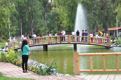
In the heart of the city is the "La Eucalera" park, a place with several hectares of eucalyptus reserved for family living.
The park has an interactive classroom so that people can develop academic activities, audiovisual consultations and make self-taught materials for the consolidation of learning about ecology and the preservation of the environment. It also has an open-air forum, 25 dining rooms, children's play areas, jogging track, outdoor gym, walkers, artificial lake and an aviary.
https://siop.jalisco.gob.mx/prensa/galerias/377
Historic Center
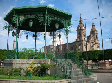
In the main square the temple in honor of the Lord of Mercy is located, within the enclosure we can find the religious history of the town through murals that show what happened between October 2 and 3, 1847. Its festivities take place on October 20 September with the "Entry of the Guilds" to October 3 of each year. Although the population is ready for the festivities from September 15 with the "Grito de Dolores" On one side is the Monument to the Lord of Mercy and the Temple of the Immaculate Virgin of Ocotlán.
Chapala Riverbank and Mountain Biking
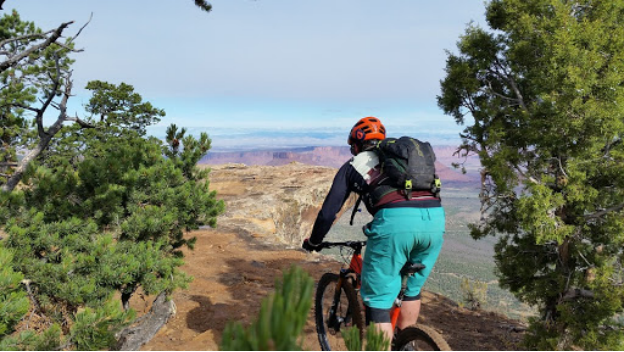
The geographical location of Ocotlán next to the shores of Lake Chapala and the mountains that surround it favor it for the practice of a sport considered extreme, Mountain Bike or Mountain Biking. Currently in this city there is a group of mountain bikers who for almost 10 years have practiced this sport constantly and intensely, even participating in regional races and organizing excursions to other places in the State of Jalisco and Nayarit. It is now a tradition for this group to organize a three-day mountain bike excursion from Guadalajara to Puerto Vallarta; in the month of January they travel the Tepic (Nayarit) route to the Puerto de San Blas, and in the month of May they travel to the Paricutín volcano.
Museum of Anthropology and History of Ocotlán
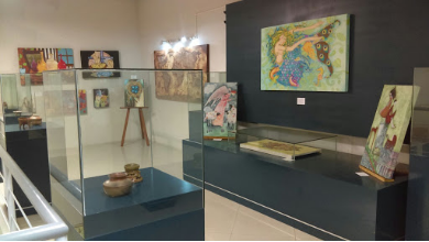
This museum was founded in 1975 has a couple of rooms within the municipal presidency. The museum was remodeled on December 18, 2008.
The collections that the museum exhibits are: the history of the municipality represented by agricultural tools, scale boats that sailed Lake Chapala and photographs of the old Ocotlán; fossil remains of prehistoric animals and plants; religious and war articles of the War of Independence.
It has an important collection of zoomorphic and anthropomorphic pieces of pre-Hispanic ceramics and photographs, as well as abundant petroglyphs in the hills of the north bank of the lake.
The museum offers children's cinema performances for weekends and holiday periods, as well as guided tours for school groups and the general public.
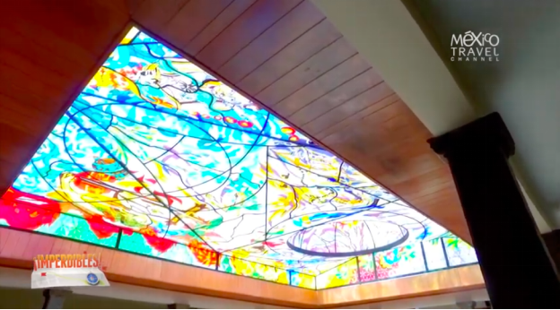
Imperdibles | Ocotlán
https://youtu.be/0SqIg6XUR24
6. History
Ocotlán was chiefdom belonging to the kingdom or lordship of Coinan, and had under its tutelage Zula, Jamay and Joconoxtle. It was conquered by Nuño de Guzmán on March 15, 1530 and was evangelized by the Franciscans in 1537.
Later the Augustinians founded a convent and called the town Santiago de Ocotlán. In 1540 there was a rebellion against the conquerors that lasted two years.
In the first third of the seventeenth century, it belonged to the mayor of Poncitlán. In 1637 the plague called "matlazahuatl" decimated the aborigines.
The oldest book in his archive is the so-called "Mixed First Book of Baptisms and Marriages" which contains data from May 6, 1660 to April 1, 1690.
Since 1825 it already had a City Council, and from that date it became part of the third canton of La Barca.
By decree number 200, published on October 5, 1886, the municipality of Poncitlán was abolished and all its police stations were added to that of Ocotlán, and on February 20, 1888, the municipality of Ocotlán lost the Poncitlán police station, which became municipality.
The exact date of creation of the municipality of Ocotlán is not known, but it is already mentioned as a town hall in the Statistics of the Province of Guadalajara dated August 15, 1823.
By decree number 1,160, published on April 9, 1906, the town of Ocotlán was granted the title of town.
On August 22, 1963, decree number 7,845 (published on September 5 of the same year) was approved, in which it was established that “due to its importance in all orders and as a stimulus to the effort and extensive work carried out by its inhabitants ”, The town of Ocotlán will be elevated to the category of city.
7. Contact Information

City Mayor: Paulo Gabriel Hernández Hernández
Phone number: +52 (392) 925 6008
Facebook: https://www.facebook.com/PauloGabrielZague
E-mail: presidencia@ocotlan.gob.mx
Website: http://web.ocotlan.gob.mx
Govt. Office Address: Hidalgo No. 65, Colonia C.P. 47800, Ocotlán, Jalisco
