Cd. Victoria, Tamaulipas 作者: 来源: 发布时间:2021-07-22
1.Population and Area
Pop: 305,155
Area: 188 km2 (city)
Elev: 316 masl

2. Natural geography
Nature and weather
Victoria is located between 23 ° 44'06 ″ north latitude and 99 ° 07'51 ″ west longitude; at an average altitude of 321 meters above sea level; it occupies 3.3% of the surface of the state of Tamaulipas; It belongs to the subregion of the same name and is located in the central region of the State, on the hydrological basin of the Purificación river and between the foothills of the Sierra Madre Oriental; crossed by the Tropic of Cancer at 23 ° 27 '. It has an area of 1,634.08 km², equivalent to 2.05% of the state territory. The urban area develops on soils and sedimentary rocks of the Quaternary, such as hills and slopes.
The city is divided into two large areas: the Sierra Madre Oriental, which covers 55.72% of the municipality, and the Northern Gulf Plain. Victoria is part of the hydrological region of San Fernando Soto la Marina with the Soto La Marina river basin and the Vicente Guerrero dam sub-basins, Corona river, San Marcos river, Grande stream and Guayalejo river. On the outskirts of the city, on the foothills of the mountains, the San Marcos and Juan Capitán streams originate. The "Altas Cumbres" Protected Natural Area is a border formed by the Sierra Madre Oriental with a height of 2000 meters to the west of the city; 30,327 hectares are reserved for the ecological conservation of the sierra, the San Marcos River basin and a stream.The land is used mainly for agriculture, covering 31% and 4% for the urban area.
The natural vegetation of Ciudad Victoria is found in the upper parts of the Sierra Madre Oriental and in the Altas Cumbres area, where oak, pine, copalillo, oyamel and red cedar forests predominate, being species typical of the sub-humid temperate climate. It can also be found in the lower parts of the city environment, where bushes such as barreta, zapotillo, laurelillo, anacahuita, ebano, mesquite, chaparro prieto, tenaza, cenizo and granjeno are located. In the induced vegetation, cultivated citrus species such as lemon and orange stand out on the outskirts of the city. In the parks, gardens, camellones and the banks of the San Marcos River, there are flowering trees such as the jacaranda and the framboyan.
Köppen Classification: Mid-Latitude Steppe and Desert Climate
This climate type is characterized by extremely variable temperature conditions, with annual means decreasing and annual ranges increasing poleward, and relatively little precipitation. This climate is typically located deep within the interiors of continents and is contiguous with the tropical desert climates of North and South America and of central Asia. This region type owes its origins to locations deep within continental interiors, far from the windward coasts and sources of moist, maritime air. Remoteness from sources of water vapor is enhanced in some regions by mountain barriers upwind.
The Köppen Climate Classification subtype for this climate is "Bsh". (Mid-Latitude Steppe and Desert Climate).
The average temperature for the year in Ciudad Victoria is 74.1°F (23.4°C). The warmest month, on average, is June with an average temperature of 82.9°F (28.3°C). The coolest month on average is January, with an average temperature of 61.5°F (16.4°C).
The highest recorded temperature in Ciudad Victoria is 119.3°F (48.5°C), which was recorded in June. The lowest recorded temperature in Ciudad Victoria is 21.2°F (-6°C), which was recorded in December.
The average amount of precipitation for the year in Ciudad Victoria is 29.1" (739.1 mm). The month with the most precipitation on average is September with 6.8" (172.7 mm) of precipitation. The month with the least precipitation on average is February with an average of 0.6" (15.2 mm). In terms of liquid precipitation, there are an average of 52.4 days of rain, with the most rain occurring in September with 8.1 days of rain, and the least rain occurring in February with 2.7 days of rain.
https://www.weatherbase.com/weather/weather-summary.php3?s=19467&cityname=Ciudad+Victoria%2C+Tamaulipas%2C+Mexico&units=
Getting there and around

Get there
By plane - The city is served by General Pedro J. Méndez International Airport, located 18 kilometers (11 mi) from the city center.
The quickest way to get from Mexico City to Ciudad Victoria is to fly which costs $2000 - $4300 and takes 3h 24m.
By bus – is the cheapest way to get from Mexico City to Ciudad Victoria, via Tampico; it costs $1000 - $1800 and takes 13h 52m.
By car – Ciudad Victoria is about 480 km from north of Mexico City, and it takes around 9h via San Luis Potosí to get there.
Car Rental – To explore Mexico’s provincial towns and cities—including its beach locations and the scenery and attractions near them— consider renting a car for your visit. Having your own car will give you more flexibility than using public transport options and, in some cases, offer you access to places which are otherwise difficult to visit without the use of a car.
Get around
Local Buses – Local buses and mini-buses (combis or micros) are available locally for a fraction of the cost of a taxi around town. You need to speak Spanish to be able to ask for directions or ask the driver to tell you where to get off.
There are 32 urban routes that circulate in the city and nearby ejidos in the surroundings, being mini-buses and buses the most used public transport, a taxi service, and school transport of the main universities, and The Pedro J. Méndez Airport, located at the outskirts of the city. Almost 59% of the urban roads have some type of paving, where the downtown sector of the city covers 95% of the roads.
The city has a bus station and terminals of several companies. The usual destinations of the bus station are Monterrey, Tampico, Altamira, North of Veracruz, Tamazunchale, Valles, Reynosa, Saltillo, Matamoros, Mante and Soto la Marina.
The main avenues and most of the traffic are Av. Alberto Carrera Torres, Francisco I. Madero Ave., Emilio Portes Gil Boulevard, Blvr. Adolfo López Mateos, Av. Rotaria, Av. Carlos Adrián Aviles, Calzada Gral. Luis Caballero, Práxedis Balboa Boulevard, as well as the road to Soto la Marina. The federal highways Mexico 81 and Mexico 80 connect with Altamira, Tampico and Madero. The city also has pedestrian bridges, six bridges for cars that cross the San Marcos River and a road hump to the west of the city.
Taxis – Taxis in most of Mexico’s towns and cities are not metered, so agree your price before you get in. Taxi travel is very affordable in Mexico, in comparison to the USA, Canada and Europe, and so provides a viable means of public transportation in Mexico. Your hotel can arrange taxis for you; some post their rates on a board in the lobby; taxi hotel rates are usually higher than cabs you hail off the street. If you speak Spanish, you will have a distinct advantage and be able to negotiate a price with the driver.
Uber is expanding rapidly across Mexico and now offers services in cities across the country, including: Mexico City, Toluca, Cuernavaca, Puebla, Querétaro, León, Aguascalientes, San Luis Potosí, Guadalajara, Monterrey, Hermosillo, Tijuana, Mexicali, and Mérida. Uber has been adding Mexican cities to its network every year, check for availability when you arrive at your destination in Mexico.
Cabify is developing also and currently operates in cities including Mexico City, Toluca, Monterrey, Puebla, Querétaro and Tijuana. Check for availability in the city you are visiting.
The services offers people with smartphones a way to book a cab through a mobile app for a pre-agreed price. Fares are comparable with Sitio type cabs (see above), and sometimes trade at a premium to this when local demand increases.
https://www.mexperience.com/transport/taxi-travel-in-mexico/#51
https://www.rome2rio.com/s/Mexico-City/Ciudad-Victoria
3. GDP
GDP: 26,400 M MXN (2010)
4. Industry characteristics
Characteristics
There is no specific information about the Economy of Ciudad Victoria, but this follows a similar patter than the economy of the rest of the State of Tamaulipas.
Its economy relies heavily on the secondary sector, with three branches of it leading the generation of employment and wealth: the manufacturing industry (auto parts, electronics, metal-mechanic), the exploitation of hydrocarbons and the mining industry.
Also, there is an important tertiary sector which amounts for around 20% of the economy’s input.
https://www.explorandomexico.com.mx/state/27/Tamaulipas/economy
Key projects: Ciudad Victoria Train Station restoration

The Ciudad Victoria Tamaulipas Mexico railway station is a historical complex dating from the late nineteenth century. Built during the Porfiriato, with neoclassical architecture, this important urban landscape is listed as a historical monument by the INAH with the registration 280410010012, even so, it was in danger due to the state of abandonment and deterioration it presented.
However, in 2019, a restoration project began that contemplates reopening tourist transport routes to nearby destinations such as Monterrey and Tampico with guided scenic tours.
https://www.elcinco.mx/cd-victoria/inician-rehabilitacion-estacion-esperan-viajes-tampico-y-mty
5. Attractions
TAMux Museum

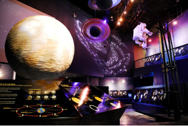
The TAMux Museum opened its doors in 2004. It is an interactive museum that has 5 thematic rooms, a high-definition 3D projection room, a temporary exhibition room, an acoustic shell and one of the 22 planetariums in the country.
The visit to the museum includes a tour of the 5 rooms of the museum, which, through interactive screens, audios, videos, texts and scale models, narrate the origin and evolution of the universe and life.
Room 1.- The Universe
Room 2.- Life
Room 3.- Evolution and Paleontology
Room 4.- Biodiversity from Tamaulipas
Room 5.- Man and Nature
http://sic.gob.mx/ficha.php?table=museo&table_id=1267
https://www.tamaulipas.gob.mx/cultura/museo-de-historia-natural-de-tamaulipas
Regional Museum of History of Tamaulipas

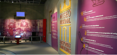
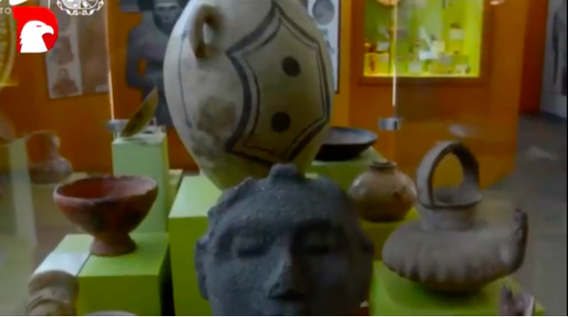
Housed in a building from the late nineteenth century was a haven for orphans, asylum Vicentino, now find this museum whose main objective is to present historical manifestations Tamaulipas. Its collection includes pieces ranging from the origins of the indigenous cultures of the region, to the modern era, which huasteca enter ceramics, works of art and objects of the colony is located.
In the Regional Museum of History you’ll find a big variety of pieces of articles of different historical periods, from the indigenous cultures to the actual era, that explain the history of the city and its evolution with time.
https://www.zonaturistica.com/en/things-to-do/tamaulipas/ciudad-victoria/regional-museum-of-history-of-tamaulipas
Siglo XXI Cultural and Recreational Park

The Siglo XXI Cultural and Recreational Park is a recreational site with different cultural and sports activities. It is located on the banks of the San Marcos River and within its facilities is the Tamux museum, the Dr. Ramiro Iglesias Leal planetarium which aims to bring children and young people closer to science, a sports gym, swimming pools, children's soccer fields, children's play areas, track, cycle track, palapas, a fountain and a green area known as the Urban Forest. It is an ideal option to visit with the whole family.
https://viajerocasual.com/que-ver-en-ciudad-victoria
https://www.granhotellasfuentes.com.mx/ciudad-victoria-mexico
6. History
Villa de Santa María de Aguayo was named after the wife of the first Count of Revillagigedo Don Juan Francisco de Güémez y Horcasitas, named Doña Antonia Cepherina Pacheco de Padilla, a native of Aguayo, Province of Santander, Spain.
The settlement was founded by José de Escandon and Helguera, Count of Sierra Gorda, during his second campaign of the Pacification and Colonization Plan of the coast of the Mexican Seno, later called New Santander, today Tamaulipas. The Spanish settlement open to the plain to the East and surrounded to the west by the Sierra Madre Oriental, a strategic location that also received breezes from the north and east. The town was administered by Captain D. Juan de Astigárraga, who drew up and carried out the first irrigation works. His work led to an increase in agriculture and, subsequently, a rapid rise in population.
In religious matters, the settlement was under the command of a Franciscan named Antonio Javier de Aréchaga, who was also in charge of the mission of San Felipe, which was founded with 150 indigenous people. That Catholic mission progressed more than those previously founded, because in the lands that were designated, they were opened by local Native Americans.
Captain Astigárraga died three years after the Villa de Agüayo was founded, and Escandon then conferred the appointment of captain to replace him in the command, Don Miguel de Córdoba.
Under the administration of the new captain, the Villa de Agüayo continued to progress, and when its statistics were formed in 1757, the settlement had in its farmhouse and estates located in its demarcation more than 1000 inhabitants who had 8600 heads of cattle and horses, and 4100 of smaller cattle.
The noble and military of Belgian descent, José de Craywinckel, when he visited the settlement, proposed to the Viceroy the reactivation of the Olazarán mine, which was abandoned in the Boca de Caballeros, since this measure would tend to give the settlement greater impetus in its prosperity, creating new interests and attracting new neighbours by this means, it being possible to expect that Villa de Aguayo would soon become one of the main populations of the new colony.
The nobleman also proposed to the Viceroy at that time, to undertake a campaign against rebellious Native Americans of the Síghue, who had their rancherías by the ravines and valleys of the Sierra Madre and in defines of their land harassed the shepherds and estates of the demarcation of Aguayo, arriving in his raids to join with the Janambre people in the attacks they undertook against the nearby Spanish settlements of Jaumave and Llera.
By this date some masonry houses were begun to be built in Aguayo, the materials for the construction of a catholic church were gathered and large sugarcane plantations were established in the surrounding lands. The neighbourhood of this town also carried out the salt trade that was going to be collected from the saltworks of San Fernando and la Marina, with the villages of the interior of Charcas and the southern part of the New Kingdom of León.
The Spanish settlement of Villa de Aguayo was distributed in perfect grid form, and in its second settlement a few leagues east of its foundation, changing by the constant claim of the Native American tribes of Janambres and Pisones. The settlement was from the beginning the geographical central node communicating with all the settlements of New Santander.
As was the Spanish provision, land was designated for the construction of the Catholic Church, the Public Square, the seat of the Captaincy of the Civil - Military and Trade Authority, spaces that over time are known as the Historical Centre, formerly known as Plaza "Hidalgo", "Plaza de Armas" or "Plaza de Catedral". The settlement was dispersed and composed of 58 families with 409 people.
The river that crossed the settlement is the so-called San Marcos, which has an irrigation ditch, whose abundance of water gave the population all the irrigation it needs for the subsistence of its inhabitants, irrigation of plots and other sowing of corn, fostering also the cultivation of the cane. The quality of the land was adequate for all fruits typical of the region and facilitated the breeding and conservation of livestock.
Its location was one of the most advantageous in favour of the Royal Treasury, both for being the first transit of the colony, and because its crops and livestock promise great movement, evidencing its growth at the beginning of its founding, which was 11 families.
Colonial Period
Unlike the modes of settlement that were commonly raised during the vice-regal period in New Spain, which followed a missionary and presidial structure, the new populations designed by José de Escandon had marked differences in the cultural, social, political and economic spheres.
The new populations that Escandon developed in the territory that is now known as Tamaulipas, called in the eighteenth-century New Santander, are based on ideas that have as a reference a way of exercising control over the development of the city and the territory, through its economic production. The direct consequences of this form of urban design marked in New Spain the opening to a new way of consolidating a border territory.
José de Escandon y Helguera, developed cattle ranching extensively and in a limited way agriculture, since for the most part "temporary" was practiced, and commerce also developed. The colonized territory was integrated and populated up to the Rio Grande, configuring the map of what is now Tamaulipas.
In addition, Escandon proposed the strategic location arrangements between each new population, a day away, which would facilitate that in cases of reoccurrence of attacks by the natives, could support each other. These are the characteristics that made the colonization of the New Santander transcendent; Although the reality did not always reflect the initial spirit of colonization, the model developed by José de Escandon proposed a new form of territorial occupation that had not been seen until the 18th century in New Spain.
Post-colonial period
After the Mexican Independence, in the decade of 1820, New Santander is renamed with the name of "Tamaulipas", and the State Congress decrees on April 20, 1825 to elevate the Villa de Aguayo to the category of "City", seat of the Three Powers and Capital of the State, approving the name of Victoria, in honour of the first President of Mexico, Guadalupe Victoria. "The Capitality Decree, Title of City and Name" is published by mandate of the First Congress, signed and sealed by Enrique Camilo Suárez, Vice Governor of Tamaulipas.
In this Capital, the Governor of the State, Lucas Fernández, on May 4 issued a decree to reject the invasion by order of the Spanish monarchy. The attempt of reconquest by the Spanish vanguard army commanded by General Brigadier Isidro Barradas, was frustrated on September 11, 1829, in Tampico, Tamaulipas; At the head of the national forces were the Generals: Felipe de la Garza Cisneros, Manuel Mier and Terán and Antonio López de Santa Anna. Battle of Tampico (1863) was one of the few battles against a foreign intervention in Mexico where the invaders have surrendered against the Mexican forces.
In 1846, in the Mexican–American War, Ciudad Victoria was occupied on December 25 by troops from the United States of America and was liberated at the end of the war. In 1898, President Porfirio Díaz sponsored the operation of the urban animal-drawn railroad that ran down Hidalgo Street to the Train Station, and a branch to the Hacienda de Tamatán, properties of Colonel Manuel González Jr. and that same year the Paseo Méndez was founded, inspired by Parisian street Champs-Élysées.
20th Century
The city began its industrial transformation in the late 19th and early 20th centuries, with the administration of Guadalupe Mainero Juárez which attracted investments and improvements to the city.
On September 15, 1910 the monument to the Heroes of Independence was inaugurated, in the "Plaza Colón" in front of the railway station "La Recoletta". In 1917 he was shot in the wall of the Municipal Pantheon, General Alberto Carrera Torres, having been tried by an illegal War Council and buried in the French Pantheon, and in 1923 General César López de Lara took the governorship of the state of Tamaulipas.
The Victorense Casino AC, formerly known as the Social and Mutualist Centre of the City, was founded in 1929. The urban and architectural structure of the city is defined in its buildings, buildings of the late 19th and early 20th centuries. The creation of the Federal Highway 85 and other road works connect the capital with the Mexico–U.S. border and the centre of the country. In 1939 Eng. Marte R. Gómez inaugurated the Olympic-type Stadium that nowadays bears his name and where the team plays Correcaminos Football Club. In 1941 the "El Petaqueño" Airport, now called the "General Pedro José Méndez" International Airport, began operations.
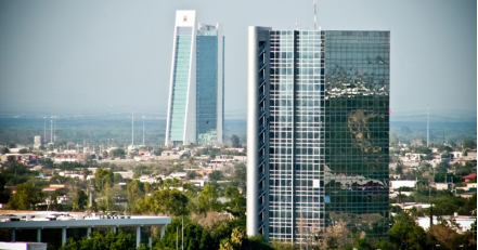
In 1951 the new Government Palace was inaugurated, built in the building where the Old Theatre "Casino" or "Juárez" was, the new "Juárez" theatre was inaugurated in 1957; The government tower known as "Crystal Tower" exists in the capital since 1980.
21st Century
The early morning of July 1, 2010, the city was hit by Hurricane Alex whose eye passed only a few kilometres between Ciudad Victoria, causing destruction in public lighting, billboards, traffic lights and an infinity of trees, as well as suspension of energy services electricity and drinking water for more than 24 hours.
In 2010, the Governmental Complex "Bicentennial Park" came into operation, which today concentrates most of the government apparatus of the state of Tamaulipas. In 2016, the restoration of the old Casa Filizola, now the Pinacoteca Tamaulipas and the main railway station of the capital, began.
7.Contact Information
City Mayor: Xicoténcatl González Uresti

Contact number: +52 (834) 318 7800
Govt. Office Address: Francisco I. Madero 102, Centro, 87000 Ciudad Victoria, Tamaulipas.
FB: https://www.facebook.com/XicoGonzalezUresti
Twitter: https://twitter.com/xicogonzalezu
Website: http://www.ciudadvictoria.gob.mx/sivic
