San Cristobal de las Casas 作者: 来源: 发布时间:2021-07-22
1.Basic data
Population: 185,917 (2010)
Area: 484 km2
Elevation: 2,200 masl
2. Natural geography
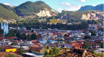
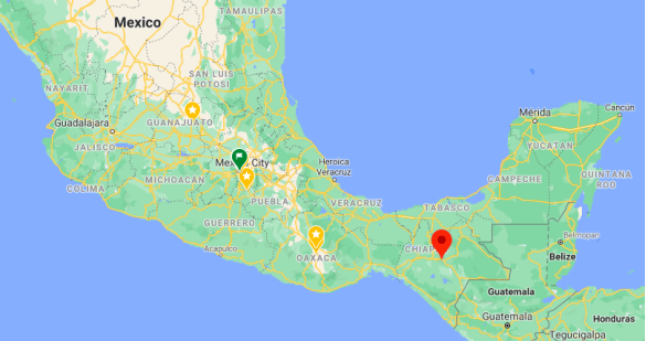
The city and municipality are located in a region called the Central Highlands. Two thirds of the municipality is made up of mountainous terrain with the rest valley floor. The city proper is located at 2,200 meters above sea level in a small valley surrounded by hills. The most important of these hills include Cerro Huitepec, San José Bocomtenelté, Cerro San Felipe, Cerro El Extranjero, Cerro Cruz Carreta, El Arcotete and Cerro Tzontehuitz. While it is in a tropical zone, its climate is temperate due to the altitude. The climate is also humid, with cloud cover in the winter months that keeps temperatures down and can produce cold nights. Average temperature between December and April is 18 °C. The area receives most of its rain in the summer to early fall. However, the cloud cover that exists in winter is generally absent and daytime temperatures can go up to 35 °C with high humidity.
Due to its high altitude the city temperatures can reach temperatures below 0 °C. Many homes burn firewood for warmth in cold weather. This can give the city a slightly smoky smell although the number of homes burning firewood for warmth has dropped in the last two decades as more homes are integrating climate-control systems under city recommendations.
The natural vegetation of the area is a forest of pine and oak trees. However, most of the surrounding hills have lost their native trees, with deforestation rates at 80%, losing 15,000 hectares just since 1980. Reasons for this include cutting for firewood, urban development, poor resource management, fires and agriculture. The deforestation has led to erosion problems blocking rivers and streams and affecting underground recharge of the area's freshwater springs. It has also negatively affected endangered species such as the golden-cheeked warbler (Dendroica chrysoparia), which winters here.
The main rivers are the Amarillo and Fogótico along with a number of streams such as the Chamula, Peje de Oro and Ojo de Agua. There are also two lakes called the Chapultepec and Cochi. The city had twenty-five natural fresh water springs, but deforestation has dried up seven and twelve flow only during the rainy season, leaving six for the city year round. These and the remaining surface lakes were declared protected in 2008.
The municipality has a number of ecological features. The Gruta de San Cristóbal is one of a number of caves in the mountains around the city just off Federal Highway 190 heading towards Comitán. This particular cave was discovered by Vicente Kramsky in 1947. The cave has only one entrance with lateral chambers. It has a total length of 10.2 km and a depth of 550 meters. The Rancho Nuevo cave has a path which extends 750 meters into the interior and is lit in various colors. Around the caves, there are campsites and horseback riding.
The municipality contains two ecological reserves called the Cerro Huitepec Private Reserve and the Rancho Nuevo Ecological Conservation Zone. Another protected area is the El Arcotete Forest located 15 km northeast of the city. It contains a natural bridge which was part of an ancient cave that was worn away.
Weather
San Cristóbal de las Casas has a mild subtropical highland climate (Köppen climate classification Cwb) moderated by its altitude. The dry season, which runs from November to April is cool with a January average of 12.3 °C (54.1 °F). Owing to its altitude and the relative aridity of the dry season, San Cristóbal de las Casas has a fairly high diurnal temperature range and nighttime temperatures are cool. Extended periods of frosts are rare, occurring only 2–3 days per year in December to February. Humidity is high (around 78%), even during the winter months, and fog or mist is quite common during the winter months, occurring 13–17 days per month with fog. Usually, this clears off during the day. The wet season, which runs from May to October is warmer, with a June average of 17.0 °C (62.6 °F) and precipitation is significantly higher during these months. Fog is less common during this time. Average annual precipitation is 1,084.7 millimetres (42.7 in) most of it concentrated in the wet season. The wettest month recorded was September 1998 when 525.8 millimetres (20.7 in) of precipitation was recorded, and the wettest day recorded was on October 4, 2005 with105 millimetres (4.1 in). Extremes range from a low of −8.5 °C (16.7 °F) to 35.8 °C (96.4 °F).
Getting there and around
The nearest major airport is Tuxtla Gutiérrez’s Ángel Albino Corzo International Airport (TGZ); it’s a gleaming, modern airport, and its location well east of Tuxtla makes it equally convenient to San Cristóbal. San Cristóbal does have a small airport of its own, but no commercial flights land there.
Taxis charge US$50 from Tuxtla’s International Airport to San Cristóbal, and around US$37.50 from San Cristóbal to the airport. Agencia Chincultik (Real de Guadalupe 34, tel. 967/678-0957, 8 a.m.–9 p.m. daily) also offers airport drop-off service for US$45 for 1–3 people; reservations are required. Alternately, take a bus to Tuxla, where cabs to the airport are US$17 (45 min).
There is also limited first-class bus service (US$10.50, 1 hr). From the airport to San Cristóbal, buses leave at 11:30 a.m., 12:30 p.m., 4 p.m., and 5:30 p.m.; from San Cristóbal back to the airport, there are only two departures at 5:30 a.m. and 3:30 p.m.
The first-class bus terminal (Av. Insurgentes at the Carr. Panamericana, tel. 967/678-0291) is seven blocks from the central plaza. You can avoid the hike down to the bus station to buy tickets by going to Ticket Bus (Calle Real de Guadalupe, tel. 967/678-8503, 7 a.m.–10 p.m. daily), a half block from the zócalo; they take cash only. The new highway between Tuxtla Gutiérrez and San Cristóbal opened in 2006 amid much fanfare, including a visit by then president Vicente Fox. The highway cuts travel time between the two cities to just over an hour, and eliminated most of the stomach-lurching curves and precipices that made the old highway so notorious.
There’s a new highway being built between Palenque and San Cristóbal, too, but it’s yet to be completed. Until it is, figure on 5–6 hours on an extremely winding road, with just one stop in Ocosingo; travelers prone to car-sickness should consider taking Dramamine beforehand.
Combis (shared vans) come and go to some of San Cristóbal’s outlying towns and villages. Their depots are located all around town.
Driving at night is definitely not recommended in Chiapas, due to the possibility of roadside robberies; this is especially a concern on the Palenque–San Cristóbal road, and most rural roadways. (Even late-night buses should be avoided, as they are occasionally targeted as well.) Driving during the daytime is safe, however, and usually quite beautiful.
The new toll road between Tuxtla and San Cristóbal makes that stretch safer and quicker, albeit with a US$3.50-per-car price tag. You can still take the old highway, too—it takes twice as long and should not be traveled at night, but there’s no toll and the views are incredible.
Getting Around San Cristóbal de Las Casas
San Cristóbal is a very walkable city, and most sights are easily reached on foot. For outlying destinations, or if you’re just tuckered out, taxis are cheap and convenient. A car or scooter can be handy for visiting outlying areas, but bear in mind that tour agencies offer reasonably priced, guided tours to most of the places you’re likely to visit with a car.
Taxi
Scores of cabs ply the streets day and night, and you can always find one parked at the central plaza. Prices are fixed, and it’s a good idea to confirm the going rate with your hotel receptionist. At the time of research, a ride anywhere around town was US$2, or US$2.50 after midnight.
Car
Driving and parking on the narrow, crowded one-way streets of San Cristóbal is an adventure, to say the least. Outside of town, be very alert for pedestrians, bicycles, and animals along the road. And again, never drive at night.
Óptima Car Rental (Calle Diego de Mazariegos 39 across from Parque La Merced, tel. 967/674-5409, 9 a.m.–2 p.m. and 4–7 p.m. Mon.–Sat., 9 a.m.–1 p.m. Sun.) is San Cristóbal’s one and only rent-a-car shop. An aging VW bug runs US$40 a day, or you can pay US$60 and up per day for something a bit more modern. Prices include taxes and insurance; the latter cannot be deducted, even if you have insurance through your credit card. Discounts are available if you pay in cash, or rent for a week or more. You may find better deals through the international agencies, which have offices at the airport and in Tuxtla.
Scooter
Scooters are cheaper and more maneuverable than cars, but far less forgiving in case of an accident—think twice about renting one if you aren’t an experienced rider. Never ride at night or in bad weather, and remember that most local drivers will not be accustomed to sharing the road with you.
Crazy Scooters (Av. Belisario Domínguez 7 at Real de Guadalupe, tel. 967/631-4329, 9 a.m.–2:30 p.m. and 4:30–7 p.m. daily) rents scooters for US$19 for two hours and US$4 per additional hour, or US$35 for the day, including helmet and map.
Bicycle
A number of sights and villages can be reached by bike, and at least two agencies in town specialize in pedaling tours. The same agencies also rent bikes: Los Pingüinos (Av. Ecuador 4-B at Real de Mexicanos, tel. 967/678-0202, 10 a.m.–2:30 p.m. and 3:30–7 p.m. daily, US$14 per day) and Ruta Nahual (Real de Guadalupe 123, cell tel. 044-967/124-2100, rutanahual@hotmail.com, 10 a.m.–1 p.m. and 4–6 p.m. Tues.–Sat., US$2–3 per hour). Or try Crazy Scooters (Av. Belisario Domínguez 7 at Real de Guadalupe, tel. 967/631-4329, 9 a.m.– 2:30 p.m. and 4:30–7 p.m. daily, US$5 first two hours, US$2 per additional hour).
https://www.hachettebookgroup.com/travel/trip-ideas/getting-to-and-around-san-cristobal-de-las-casas/
3. Economy
The GDP in 2010 was of 11.236 millions MXN.
https://imco.org.mx/ciudades2010/ciudades/62_Sancristobaldelascasas.html
4. Industry
San Cristóbal has the second-lowest rate of economic marginalization in the state of Chiapas following Tuxtla Gutiérrez. Only 4.5% of workers do not receive a salary or a regular income. Approximately 9% are employed in agriculture, compared to 54.86% regionally and 47.25% in the state. 21% are employed in construction, energy and transportation. The most important sector by economic output is mining. About 600 truckloads of jade, gravel, stone and metals are exported from San Cristóbal daily. Most of the material is destined to other municipalities in the region, although some goes to other cities in Chiapas and to states such as Tabasco and Campeche. This heavy strip mining has gradually eaten away at the natural landscape of some areas and has negatively affected the recharge of surface and subsurface water.
The most important economic sector is commerce, services and tourism, which employs almost 67% of the workforce compared to 29% for the region and 37% for the state. The city has become a renowned tourist location for its preserved colonial architecture and retention of indigenous culture and traditions. Many residents of the city wear indigenous clothing regularly. Market vendors in the city are known for being very aggressive when trying to secure a sale.
The municipality contains over 80 hotels with more than 2,000 rooms. The city government serves tourists through traditional information booths with guided tours and also offers “I-Pod tours” where tourists may rent an iPod which uses a GPS system to identify where any given tourist is and provide them with information regarding their surroundings. These tours allow visitors to roam the city and listen/read about the areas in which they are located.
Since the Zapatista uprising in 1994, the city has developed a type of cult tourism focusing around the EZLN. This tourism attracts those interested in both leftist political beliefs and indigenous activism who come to see where the events of the 1990s happened as well as what is going on now. This tourism has spurred the creation of Zapatista-themed shops which sell EZLN shirts and other souvenirs. This tourism has been given the name of “Zapaturismo” or “Zapatourism”. The term originally was derogatory and referred to the large number of leftist activists which converged on the city after the EZLN uprising began. Since then, the term receives mixed reviews with some finding humor in it.
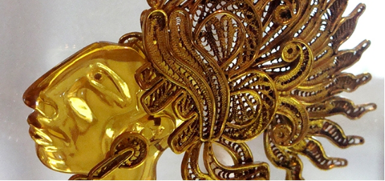
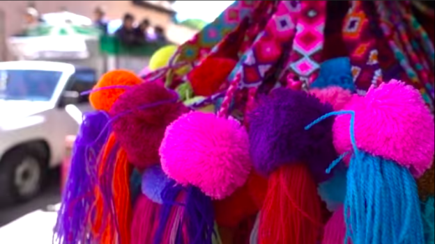
The most important manufactured goods produced in the city are jade, textiles and amber, although others such as ceramics, metal works, carved wood products, clothing and filigree jewelry can be found as well. There is a large tianguis or open air market at Santo Domingo which specializes in selling these locally produced products.
There has been a recent problem with fake amber being sold on the street, either made of plastic or glass. True Chiapas amber is extracted from the town of Simojovel to the north. There is a great price difference between the real and fake amber, and this price difference can be enough to put authentic amber vendors out of business. Many of the sellers of fake amber are successful because many people, especially foreign tourists, do not know how to determine what is real. However, one indicator is price, as true amber cannot be sold for the very low prices that street vendors offer.
Expansion of the superhighway Tuxtla Gutiérrez-San Cristobal de las Casas
As part of the National Infrastructure Agreement of the private sector, which will have an investment of 950 million pesos, the Tuxtla-San Cristóbal superhighway will be expanded for 30 kilometers. The project would also contemplate expanding the SCLC-Palenque highway.
The Tuxtla-San Cristóbal toll road is 46.5 kilometers long; It is managed by Concesionaria de Autopistas del Sureste (CAS) since 2007, the same company from Spain that has the Arriaga-Ocozocoautla highway under its jurisdiction.
This expansion would be in charge of the companies Ainda Energía & Infraestructura and Aldesa, companies that will hold 49 and 51 percent of the shares, respectively.
Currently the route has two lanes and five bridges, its capacity ranges between 9,000 and 9,500 units.
https://diariodechiapas.com/portada/ampliacion-de-la-via-tgz-sclc-sera-una-realidad/133825
5. Touristic sites
San Cristobal’s Churches
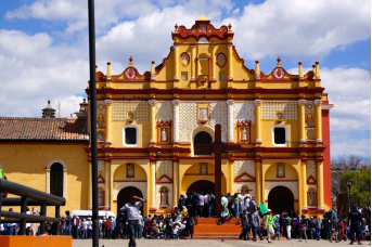
During any visit to San Cristobal de las Casas, you’ll undoubtedly wind up at the town’s central Cathedral, which overlooks the main plaza in the center of town. If dressed appropriately, go inside this yellow structure to see local residents stopping to pray among the gold leaf flanked interior. This Cathedral dates back more than two centuries and is the site of Pope Francis’s visit in February 2016.
don’t only visit the cathedral because you’ll find many beautifully adorned structures all around town. Perhaps most notably is the lovely Templo Santo Domingo with its pink facade. This historic church and former convent dating back to the 1700s is arguably the most beautiful church in San Cristobal de las Casas.
There are two other churches to visit, if not for the religious structures themselves, then go for the spectacular views of San Cristobal de las Casas! If you have the energy, hoof it up to either of these two churches that are perched atop hills in San Cristobal de las Casas: Iglesia de Guadalupe and Iglesia de San Cristobal. You’ll not only be rewarded by the ornate churches, but you’ll earn stunning views of San Cristobal de las Casas down below.
Museums
You’ll also find over a half dozen museums throughout San Cristobal de las Casas. Here are three of the most notable museums in town:
·The Centro de Textiles del Mundo Maya ($55 MXN) is arguably the best museum in town, highlighting textile production throughout the region.
·The intimate Na Bolom ($40 MXN) highlights the region’s culture through textiles and historical documents.
·Meanwhile, the Museo de Ambar (Amber Museum, $25 MXN) is another small museum that gives a look into the amber found here in addition to purchasing jewelry at the adjoining store.
Walk arounds
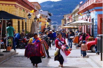
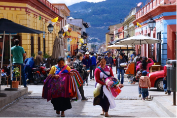
Yet perhaps the best thing to do in San Cristobal de las Casas is to stroll along the many pedestrian-friendly streets and simply soak it all in. The main pedestrian thoroughfare is Real de Guadalupe. This central walkway is always bustling with local life and lined with some great restaurants and cafes.
Stop into a cafe to sip some local Chiapan coffee in the morning and switch over to pox, a local liquor, by nightfall. Be sure to head over to San Cristobal’s Zocalo, the central plaza, which is a great place for people watching, relaxing, and street vendors. There’s also no shortage of shopping opportunities either as you can find an abundance of locally made handicrafts at the boutiques along Real de Guadalupe in addition to the sprawling local craft market.
Also, consider taking the Free Walking Tour of San Cristobal de las Casas. It’s a two-hour tip-based walking tour of the city that visits many of those locations while a local guide provides a wealth of information of San Cristobal de las Casas’s history, cuisine, culture, and practical information to know during your stay. It’s a great overview of San Cristobal that can make for a particularly nice intro for new visitors to the city. This walking tour departs every day at 10:00 am and 5:00 pm, from Plaza de la Paz, which is the main central plaza in front of the Cathedral.
https://www.roamingaroundtheworld.com/things-san-cristobal-de-las-casas-mexico/
Everybody's CRAZY about SAN CRISTOBAL DE LAS CASAS
https://www.youtube.com/watch?v=0cAeniyJumw
7. History and Culture
The city was founded as Villa Real de Chiapa in 1528 by Diego de Mazariegos in what was called the Hueyzacatlán Valley, which means “pasture” in Nahuatl. From then on, the city went through a number of name changes: to Villa Viciosa in 1529, to Villa de San Cristóbal de los Llanos in 1531, and to Ciudad Real in 1536. It was changed to Ciudad de San Cristóbal in 1829. “de las Casas” was added in 1848 in honor of Bartolomé de las Casas. There were some modifications in the early 20th century to the name but it returned to San Cristóbal de las Casas in 1943. In the Tzotzil and Tzeltal languages the name of the area is Jovel, “the place in the clouds”.
The area did not have a pre-Hispanic city. After defeating the Zoques in the Northern Mountains and the Chiapans of this area, Diego de Mazariegos founded the city as a military fort. This city and much of what would be the state of Chiapas came under the Captaincy General of Guatemala in 1532 headed by Pedro de Alvarado. San Cristóbal received its coat of arms in 1535 from Carlos V and it was officially declared a city in 1536. The city gained the rank of Alcadía Mayor in 1577 which gave it authority over much of Chiapas north of it. The intendencia of Chiapas was created in 1786 combining San Cristóbal’s territory with that of Tuxtla and Soconusco, with the government in San Cristóbal. In 1821, the city followed the Comitán de Domínguez’ declaration of independence from Spain and the Captaincy General of Guatemala. However, the city and the rest of Chiapas became a part of Mexico in 1824, with the capital established here.
In 1829, the name Ciudad Real was changed to San Cristóbal. In the 19th century, the state government would shift back and forth between San Cristóbal, in the highlands dominated by Conservatives, and Tuxtla, dominated by Liberals. Independent tendencies arose again in 1853, when the Plan of Yalmús was announced declaring the then Mexican Constitution null. Conservative forces attacked the city in 1857 but were dislodged shortly thereafter by Liberal Angel Albino Corzo. The last of French forces were expelled from the city in 1864. The state government was moved from San Cristóbal to Tuxtla for good in 1892 by the Liberal government. There was a failed attempt in 1911 by Conservatives in San Cristóbal and neighboring San Juan Chamula to force the return of the capital.
In 1915, the state went to the municipality system with San Cristóbal becoming a municipality. Originally, it had jurisdiction over communities such as San Lucas, Zinacantán, San Felipe Ecatepec, Tenejapa, San Miguel Mitontic, Huixtan and Chanal, but these would later separate to become municipalities in their own right.[1] In the 20th century, the outskirts of the city become filled with open pit mines for gravel and sand. There was even one opened on a hill in the San Diego and La Florecilla neighborhoods, near the historic center called Salsipuedes. These prompted environmental and local community organizations to protest, stating that the valley is a closed water basin and the mining negatively affects potable water supplies. Salsipuedes was closed in the 2000s.
The city was declared a national historic monument in 1974.
San Cristóbal became the center of political activism with the election of Samuel Ruiz as bishop of Chiapas in 1960. In the 1960s and 1970s, the traditional Catholic Church was losing indigenous adherents to Protestant and other Christian groups.[15] To counter this, Ruiz supported and worked with Marist priests and nuns following an ideology called liberation theology. In 1974 he organized a statewide Indian Congress with representatives from 327 communities of the Tzeltal, Tzotzil, Tojolabal and Ch'ol peoples as well as Marists and the Maoist People’s Union. This congress was the first of its kind with the goal of uniting the indigenous peoples politically. These efforts were also supported by leftist organizations from outside Mexico, especially to form unions of ejido organizations. These unions would later form the base of the EZLN organization. These efforts would also create a “new” type of Catholic in the state called “Word of God” Catholic. These would shun the “traditionalist” Catholic practice mixed with indigenous rites and beliefs. It would also create a split in many communities as the “Word of God” Catholics were loyal directly to the bishop in San Cristóbal, with traditionalists loyal to local cacique leaders.
Activism and resentment continued from the 1970s to the 1990s. During this decade, the Mexican federal government adopted neoliberalism, which clashed with the leftist political ideas of liberation theology and many of the indigenous activist groups. Despite the activism, economic marginalization among indigenous groups remained high, with resentment strongest in the San Cristóbal region and immigrant communities living in the Lacandon Jungle.
The grievances of these activists would be taken up by a small guerrilla band led by a man called only “Subcomandante Marcos.” His small band, called the Zapatista Army of National Liberation (Ejército Zapatista de Liberación Nacional, EZLN), came to the world’s attention when on January 1, 1994, the day the NAFTA treaty went into effect. On this day, EZLN forces occupied and took over the towns of San Cristóbal de las Casas, along with six other Chiapas communities. They read their proclamation of revolt to the world and then laid siege to a nearby military base, capturing weapons and releasing many prisoners from the jails. Ruiz negotiated between the EZLN and authorities even though his leftist activism made him suspect to many authorities. This would undermine efforts and eventually the Catholic Church would split from the Zapatista movement. However, the negotiations would lead to the San Andrés Accords and ended the rebellion peacefully. By the time he died in 2011, Ruiz was locally given the name of “Tatic”, which means “father” in Tzotzil, and received numerous distinctions including the Simón Bolívar Prize from UNESCO and the International Human Rights Award in Nuremberg.
8.Contact Information
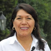
City Mayor: Jerónima Toledo
Contact number: +52 (967) 678 0730
Govt. Office Address: Eje vial S/N, Los Pinos, 29280 San Cristóbal de las Casas, Chis.
Facebook: https://www.facebook.com/JeronimaOficial
Twitter: https://twitter.com/GobSanCristobal
Website: https://www.sancristobal.gob.mx/directorio-municipal/
