Westport, Connecticut 作者: 来源: 发布时间:2021-07-20
I.Population and Area
₋Area
Land: 33.45 sq mi (86.6 km2)
₋Population
Total: 26,391
Density: 1,322.2/sq mi (510.5/km2)
II.Natural Geography
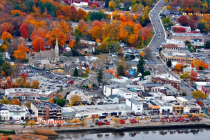
₋Westport is a town in Fairfield County, Connecticut, United States, along Long Island Sound within Connecticut's Gold Coast. It is 52 miles (84 km) northeast of New York City. The town had a population of 26,391 according to the 2010 U.S. Census, and is ranked 19th among America's 100 Richest Places as well as third in Connecticut, with populations between 20,000 and 65,000.
₋According to a publication by the 2010 Census, Westport has a total area of 33.45 square miles (86.6 km2) of which 19.96 square miles (51.7 km2) (59.67%) is land with the remaining area of 13.49 square miles (34.9 km2) (40.20%) water.
₋Westport is bordered by Norwalk on the west, Weston to the north, Wilton to the northwest, Fairfield to the east and Long Island Sound to the south.
III.GDP
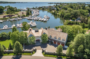
₋The average salary in Westport, CT is $66k. Trends in wages decreased by -1.6 percent in Q1 2020. The cost of living in Westport, CT is 89 percent higher than the national average. The most popular occupations in Westport, CT are Operations Support Specialist, Administrative Assistant, and Structural Engineer which pay between $41k and $128k per year. The most popular employers in Westport, CT are Bridgewater, Bridgewater & Associates, Inc., and Terex Corporation.
₋Website: https://www.payscale.com/research/US/Location=Westport-CT/Salary
IV.Industrial Characteristics
₋In the 1840s diverse newcomers including Irish and Italian immigrants arrived to build the railroad and work in the factories along the Saugatuck River. Before World War I, noted artists and writers began living here and the town remains a hub for arts and culture. Light industry and farming later yielded to urban pressures and by 1950 Westport had become primarily a residential suburban community.
₋Local designer Miggs Burroughs was asked to design the Westport town flag as part of Westport's 150th birthday celebration in 1985. Miggs based his design concept on the river, which is central to Westport's character and its history. Farmers wanted a parish to call their own and formed Westport from the western piece of Fairfield's parish on the east side of the river, and the eastern piece of Norwalk's parish, on the west side of the river.
₋Website: https://www.westportct.gov/about/town-hall/town-history-symbols
V.Attractions
1.Sherwood Island State Park
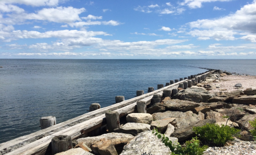
₋Sherwood Island State Park is a public recreation area on the shore of Long Island Sound in the Greens Farms section of Westport, Connecticut. The state park offers swimming, fishing, and other activities on 238 acres (96 ha) of beach, wetlands, and woodlands. Sherwood Island is numbered as Connecticut's first state park because state purchase of land at the site began in 1914. The park is managed by the Connecticut Department of Energy and Environmental Protection.
₋In the 1640s, several colonists from the Town of Fairfield, who came to be known as the "Bankside Farmers," settled in the area that included Fox Island, which was later renamed Sherwood Island, administering the island in common.
₋Daniel Sherwood settled on Fox Island in 1787. During the 1800s, his large family farmed the uplands on the west side of the island and operated a gristmill on the Mill Pond. Many farmers shared the Machamux salt marsh. (See also Henry Burr Sherwood.) By the 1860s, the place was known as "Sherwood's Island." Gallup Gap Creek at one time ran north and south on the east side of the park but not far from the center. Some have said that what was known previously as Sherwood's Island was only west of that creek, which was later dammed up to help water flow at the grist mill.
₋When the Connecticut State Park Commission was formed in 1911, one of its main tasks was to find and develop shore parks along Connecticut's coastline. Field secretary Albert Turner walked the shoreline seeking suitable sites: several hundred acres of undeveloped land with natural scenic beauty, fronting on a good beach, and far enough from cities to ensure freedom from sewage pollution and lack of interference with industrial development. He concluded that Sherwood Island was the only suitable site in Fairfield County.
₋At that time, the land had many owners. Acting for the state, Westport farmer and public citizen William H. Burr Jr., who led the fight to create the park, bought two small parcels in 1914, including a 5-acre (20,000 m2) strip of beachfront, giving Sherwood Island its designation as Connecticut’s first state park, although it took another two decades for the park to be widely used. Various parcels bought by 1915 amounted to 24 acres (97,000 m2) by deed, although a state survey showed they in fact amounted to 30 acres (120,000 m2). The park at this point had 23,350 feet (7,120 m) of shorefront.
₋In 1923, another 18 acres (73,000 m2) north of the island were acquired for possible use as a parking lot, although they were unconnected to the other 30 acres (120,000 m2). Some access to the park at this time was available through the Town of Westport's Burying Hill Beach. At this point, further development of the park stalled when local landowners, led by local property owner Edward Gair, persuaded a town meeting to oppose further land acquisitions and spending on the park. The state legislature, reluctant to act without local approval, defeated a proposal from the State Parks Commission to spend $500,000 on further park development. Large beachfront properties were acquired by developers. For the next nine years, supporters and opponents in Westport and Fairfield County debated the matter. By 1932, the state leased more land in what became the park (with an option to buy within five years) and opened the park that summer.
₋On April 29, 1937, with the lease and option to buy nearing expiration, Governor Wilbur L. Cross signed two bills with a total appropriation of $485,000 for the state to buy more land and develop the park. This was a victory for the Connecticut Forestry Association, the Fairfield County Planning Association, and supporters, including William H. Burr, who came to be known as the father of the park.
₋In the 1950s, the U.S. Army Corps of Engineers constructed jetties and extended the two beaches. In 1959, the state built an art deco styled pavilion/bathhouse. In 2002, a memorial was dedicated to the victims of the September 11, 2001 attacks.
₋Address: Sherwood Island Connector, Westport, CT 06880, United States
₋Phone: +1 203-226-6983
₋Website: https://portal.ct.gov/DEEP/State-Parks/Parks/Sherwood-Island-State-Park
₋
2.Long Island Sound
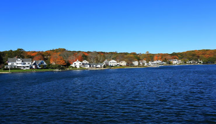
₋Long Island Sound is a tidal estuary of the Atlantic Ocean, lying predominantly between the U.S. state of Connecticut to the north, and Long Island in New York to the south. From west to east, the sound stretches 110 miles (177 km) from the East River in New York City, along the North Shore of Long Island, to Block Island Sound. A mix of freshwater from tributaries and saltwater from the ocean, Long Island Sound is 21 miles (34 km) at its widest point and varies in depth from 65 to 230 feet (20 to 70 m).
₋Major Connecticut cities on the Sound include Stamford, Norwalk, Bridgeport, New Haven, and New London. Cities on the New York side of the Sound include Rye, Glen Cove, New Rochelle, Larchmont and portions of Queens and the Bronx in New York City.
₋Mansions and wealthy neighborhoods characterize a good portion of the coast of the sound from Port Jefferson and east on Long Island; and from Pelham Manor and New Rochelle (on the mainland of New York) to Madison in Connecticut.
₋Website: https://soundwaters.org/long-island-sound-facts/
₋
3.Calf Pasture Beach
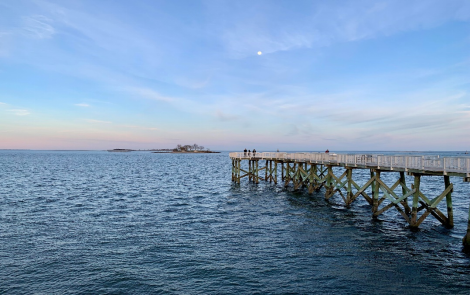
₋Calf Pasture Beach is an historically significant park and beach in Norwalk, Connecticut.
₋The area of the park lands (including adjacent Shady Beach Park and Taylor Farm Park) is approximately .45 square miles.
₋The beach is accessible by road or by public transit; Norwalk Transit District provides direct bus service to the park and the East Norwalk Metro-North station is about one mile to the north along Calf Pasture Beach Road, Gregory Boulevard, and East Avenue. East Avenue also provides access to I-95 at exit 16.
₋The area now known as Calf Pasture was used by Connecticut colony settlers in the 17th century as grazing land for cows.
₋The beach was used for disembarkation and encampment during the Tryon raid of the American Revolutionary War in 1779. After having conducted retribution raids at New Haven and Fairfield, William Tryon led 2,600 British troops by boat to Norwalk at approximately 5:00 p.m. on July 10, 1779. They landed near the Round Beach island at the Calf Pasture peninsula where they spent the night. The next day they set off on the burning of Norwalk that left only 6 houses standing after the raid.
₋In 1917 the Norwalk City legislature authorized the city to acquire and create a park at Calf Pasture Beach. Property condemnation to acquire the land was started in 1919. In 1922 the descendants of the Betts, Marvin, and Taylor families, who owned much of the adjoining property, donated their lands to the city. The park formally opened in 1924 while work on buildings and nearby roads was still underway.
₋Additional buildings and sidewalks were constructed at Calf Pasture in 1935 with funding provided by the Federal Emergency Relief Administration. Many of the buildings and sidewalks were washed away during the hurricane of September 1938. They were then replaced by Works Progress Administration workers.
₋Shady Beach was acquired in the 1960s. From 2000 to 2006 the Kayak for a Cause charitable fundraising event was held at Calf Pasture Beach. In 2007 that event was held at Veterans Park (also in East Norwalk) on the Connecticut shore. In 2008 it returned to Calf Pasture Beach.
₋All of the park facilities (Calf Pasture Beach, Shady Beach, and Taylor Farm) are still owned and maintained by the City of Norwalk.
₋Address: Calf Pasture Beach Rd, Norwalk, CT 06851, United States
₋Phone: +1 203-854-7806
₋Website: https://www.norwalkct.org/303/Norwalk-Beaches
VI.History
₋The earliest known inhabitants of the Westport area as identified through archaeological finds date back 7,500 years. Records from the first white settlers report the Pequot Indians living in the area which they called Machamux translated by the colonialists as beautiful land. Settlement by colonialists dates back to the five Bankside Farmers; whose families grew and prospered into a community that continued expanding. The settlers arrived in 1693, having followed cattle to the isolated area. The community had its own ecclesiastical society, supported by independent civil and religious elements, enabling it to be independent from the Town of Fairfield. As the settlement expanded its name changed: it was briefly known as "Bankside" in 1693, officially named Green's Farm in 1732 in honor of Bankside Farmer John Green and in 1835 incorporated as the Town of Westport.
₋During the revolutionary war—on April 25, 1777, a British force of 1,850 under the command of the Royal Governor of the Province of New York, Major General William Tryon landed on Compo Beach to destroy the Continental Army’s military supplies in Danbury. Minutemen from Westport and the surrounding areas crouched hiding while Tryon's troops passed and then launched an offensive from their rear. A statue on Compo beach commemorates this plan of attack with a crouching Minuteman facing away from the beach, looking onto what would have been the rear of the troops. A sign on Post Road East also commemorates this event.
₋The Town of Westport was officially incorporated on May 28, 1835, with lands from Fairfield, Weston and Norwalk. Daniel Nash led 130 people of Westport in the petitioning of the Town of Fairfield for Westport’s incorporation. The driving force behind the petition was to assist their seaport’s economic viability that was being undermined by neighboring towns’ seaports. For several decades after that, Westport was a prosperous agricultural community distinguishing itself as the leading onion-growing center in the U.S. Blight caused the collapse of Westport's onion industry, leading to mills and factories replacing agriculture as the town's economic engine.
₋Agriculture was Westport's first major industry. By the 19th century, Westport had become a shipping center in part to transport onions to market.
₋Starting around 1910 the town experienced a cultural expansion. During this period artists, musicians, and authors such as F. Scott Fitzgerald moved to Westport to be free from the commuting demands experienced by business people. The roots of Westport's reputation as an arts center can be traced back to this period during which it was known as a "creative heaven."
₋In the 20th century a combination of industrialization, and popularity among New Yorkers attracted to fashionable Westport—which had attracted many artists and writers—resulted in farmers selling off their land. Westport changed from a community of farmers to a suburban development.
₋In the 1950s through to the 1970s, New Yorkers relocating from the city to the suburbs discovered Westport's culture of artists, musicians and authors. The population grew rapidly, assisted by the ease of commuting to New York City and back again to rolling hills and the "natural beauty of the town." By this time Westport had "chic New York-type fashion shopping" and a school system with a good reputation, both factors contributing to the growth.
₋By the 21st century, Westport had developed into a center for finance and insurance, as well as professional, scientific and technical services.
VII.Other Information
₋Transportation
₋Interstate 95, the Merritt Parkway, and U.S. 1, as well as the Saugatuck River, run through Westport.
₋Westport has two train stations, Green's Farms and Westport on the Metro-North Railroad's New Haven Line, which serves Stamford and Grand Central Terminal in New York City or New Haven-Union Station. This line is shared with Amtrak trains as it is part of the Northeast Corridor, but no Amtrak services stop at Green's Farms or Westport. The nearest Amtrak stations are at Bridgeport (10 miles) and Stamford (12 miles).
₋"Main to Train" study
₋A recent initiative by residents of the Town of Westport, Connecticut. It is part of a greater interest to improve pedestrian and cyclist options from the major places of interest in town: downtown Westport to the Westport Train Station. This approximate two-mile stretch of road is most directly accessible via Post Road East (U.S. Route 1) to Riverside Avenue. The third iteration of the study will more specifically address ways in which this path can be improved for people not travelling by car; the first report considered the conditional state of the path and the second analyzed traffic conditions.
₋The Westport Planning and Zoning Commission is interested in offering more sustainable and accessible transit options: in 2017 the Commission released a report on alternate transit options, complete with surveys of town residents and maps of current sidewalks and bike paths. The lack of sidewalks on some two-way arterial and many collector streets may increase the potential for accidents. This is occurring in tandem with the Connecticut Department of Transportation’s notable laws which support users of all transit forms: the Complete Streets Law of 2009, the 2014 Vulnerable User Law, and the 2015 Bike Bill. A true application of change in the post-Complete Streets law is the restriping of road shoulders by the DOT across the state, including the many, already narrow, two-way streets. The narrowing of roadsis known to encourage slower, safer driving, which protects pedestrians and cyclists, as well as auto users. This form of traffic calming is thus in line with Vision Zero, an interest by New Urbanists and city planners focused on reducing traffic-caused injuries and fatalities.
₋The Norwalk Transit District, with several routes available for Westporters due to support by the Town of Westport, offers another form of transit for mainly commuting use.
VIII.Contact Information
₋Government
Type: RTM
1st selectman Jim Marpe (R)
2nd selectwoman Jennifer Tooker (R)
3rd selectwoman Melissa Kane (D)
₋City Hall
₋Address:
110 Myrtle Avenue
Westport CT 06880
₋Website: https://www.westportct.gov/government/staff-directory
