Stevensville, Montana 作者: 来源: 发布时间:2021-01-29
I. Population and Area
₋ Area
Land: 0.98 sq mi (2.54 km2)
₋ Population (2018)
Total: 2,025
Density: 700/km2 (1,800/sq mi)
II. Natural Geography

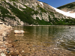
St. Mary’s Peak
₋ Stevensville is officially recognized as the first permanent settlement in the state of Montana. Forty-eight years before Montana became the nation's 41st state, Stevensville was settled by Jesuit Missionaries at the request of the Bitter Root Salish Amerindians.
III. GDP
₋ The Estimated median household income in 2017: $45,185 (it was $27,951 in 2000)
₋ Estimated per capita income in 2017: $25,223 (it was $14,700 in 2000)
₋ Website: http://www.city-data.com/city/Stevensville-Montana.html
IV. Industrial Characteristics
- Employment by Occupations
From 2016 to 2017, employment in Stevensville, MT grew at a rate of 8.84%, from 803 employees to 874 employees.
The most common job groups, by number of people living in Stevensville, MT, are Office & Administrative Support Occupations (134 people), Education Instruction, & Library Occupations (89 people), and Sales & Related Occupations (84 people). This chart illustrates the share breakdown of the primary jobs held by residents of Stevensville, MT.
- Employment by Industries
From 2016 to 2017, employment in Stevensville, MT grew at a rate of 8.84%, from 803 employees to 874 employees.
The most common employment sectors for those who live in Stevensville, MT, are Retail Trade (138 people), Health Care & Social Assistance (124 people), and Educational Services (109 people). This chart shows the share breakdown of the primary industries for residents of Stevensville, MT, though some of these residents may live in Stevensville, MT and work somewhere else. Census data is tagged to a residential address, not a work address.
V. Attractions
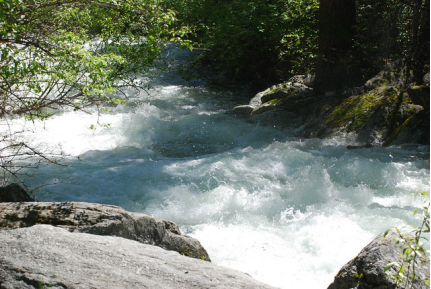
Kootenai Creek Trail

₋ North Kootenai Lake Via Kootenai Creek Trail is a 31.2 kilometer moderately trafficked out and back trail located near Stevensville, Montana that features a lake and is rated as moderate. The trail I primarily used for hiking, trail running, camping, and backpacking and is best used from July until September. Dogs are also able to use this trail.
₋ Arriving at Kootenai Creek trailhead, you’ll find adequate parking, hitching rails and a stock ramp—just in case you brought your horse—and the all-important vault toilet. There are also signs advising how to hike safely in this part of the Bitterroot National Forest. And, yes, bring bear spray—a must for any Montana hiking trail.
₋ Our Kooetenai Creek hiking day usually go like this: When we start our hike around 7 a.m., the trail belongs to us for about the first two hours, although we do have to be vigilant for gifts that horses have deposited along the way—Kootenai Creek Trail is multi-use.
₋ On the return portion of the hike, the traffic picks up. We meet hikers of all ages on the trail, many bring their dogs along and some are toting a fishing pole as they look for just the right spot on the creek for fly-fishing. It’s a friendly crowd and, every time, we return to the trailhead with lots of advice for the next hike.
₋ Website: https://www.alltrails.com/trail/us/montana/north-kootenai-lake-via-kootenai-creek-trail?u=m https://myitchytravelfeet.com/kootenai-creek-trail-montana/
2. St. Mary’s Mission

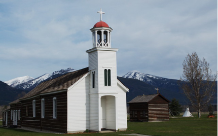
₋ The Historic St. Mary's Mission is a mission established by the Society of Jesus of the Catholic Church; located now on 4th street in modern-day Stevensville, Montana. Founded in 1841 and designed as an ongoing village for Catholic Salish Indians, St. Mary's was the first permanent settlement made by European descendants in what became the state of Montana. The mission structure was rebuilt in 1866, with it being added to the National Register of Historic Places in 1970.
₋ Carpenter Brother Claessens led the building of the church. As construction began under the supervision of Pierre-Jean De Smet, he described St. Mary's and the Salish workforce as follows:
₋ The women hewed down the timber, assisted by their husbands, with the greatest alacrity and expedition, and in a few weeks we had constructed a log church, capable of holding 900 persons. To ornament the interior, the women placed mats of a species long grass, which were hung on the roof and sides of the church, and spread over the floor,-- it was then adorned with festoons formed of branches of cedar and pine.
₋ Houses with lawns were built in harmony with Nicolas Point's plan, although it made the village open to attack. A palisade shielded the church. The first communion was at Easter 1842. At this time, Chief Victor held the position as principal representative for the Bitterroot Salish. Father Anthony Ravalli joined the mission in 1845. He inoculated the Indians against smallpox and ran the dispensary. In 1846, the fields yielded 7,000 bushels of wheat and a considerable quantum of garden crops. However, by this time many Salish Indians slowly turned their backs to the mission and took up their former life. They felt betrayed with the establishment of a mission at Colville for their Blackfeet enemies.
₋ The mission complex is open for tours from April through October. The buildings include the chapel with an attached residence, the infirmary, a dovecote, a cabin with Salish artifacts, and a visitor's center which contains a museum, research library, art gallery and gift shop.
3. St. Mary’s Peak

₋ St. Mary’s Glacier is a semi-permanent snowfield located in Arapaho National Forest in the US state of Colorado. St. Mary’s Glacier is 2.5 mi (4.0 km) southeast of James Peak.
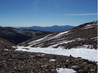
₋ St. Mary’s Peak Trail is a 12.2 kilometer heavily trafficked out and back trail located near Stevensville, Montana that offers scenic views and is rated as moderate. The trail is primarily used for hiking and bird watching. Dogs are also able to use this trail.
₋ St. Mary Peak rises 9300 feet above sea level and over 6000 feet above the valley floor. At its pinnacle is a fire lookout station that offers breathtaking views for miles around. The 4.5 mile hiking trail is considered moderate in difficulty, although there is a 2400' gain from the parking area to the top.
₋ Travel 3.5 miles south of Stevensville junction on Highway 93. Turn west on Indian Prairie Loop. Continue west 1.8 miles to St. Mary's Road, turn right and continue 1 mile to McCalla Ridge Road and St. Mary's Peak Road 739 junction. Travel on that road about 14 miles to the road's end at the trailhead.
₋ Contact Information
TEL: 406-777-5734
Address:
▫ P.O. Box 211
▫ 315 Charlo Street
▫ Stevensville, MT 59870
Tuesday - Saturday 11 to 3
₋ Email: stmary@cybernet1.com
₋ Website: https://www.alltrails.com/trail/us/montana/saint-mary-peak-trail?u=m https://en.wikipedia.org/wiki/Saint_Mary%27s_Glacier
VI. History
₋ Through interactions with Iroquois working in the fur trade between 1812 and 1820, the Bitter Root Salish learned about Christianity and Jesuit missionaries (the Blackrobes as they were called) that worked with Native Americans teaching about agriculture, medicine, and religion. Interest in these "blackrobes" grew among the Salish and, in 1831, four young Salish men were dispatched to St. Louis, Missouri to request a priest to return with them to their homeland of present-day Stevensville. The four Salish men were directed to the home and office of William Clark (of Lewis and Clark fame) to make their request. At that time Clark was in charge of administering the territory they called home. Through the perils of their trip two of the Salish died at the home of General Clark. The remaining two Salish men secured a visit with St. Louis Bishop Joseph Rosati who assured them that missionaries would be sent to the Bitter Root Valley when funds and missionaries were available in the future.
₋ Again in 1835 and 1837 the Bitter Root Salish dispatched men to St. Louis to request missionaries but to no avail. Finally in 1839 a group of Iroquois and Salish met Father Pierre-Jean DeSmet in Council Bluffs. The meeting resulted in Fr. DeSmet promising to fulfill their request for a missionary the following year.
₋ DeSmet arrived in present-day Stevensville on September 24, 1841, and called the settlement St. Mary's. Construction of a chapel immediately began, followed by other permanent structures including log cabins and Montana's first pharmacy. Father Ravalli, Jesuit priest and doctor, was the builder.
₋ In 1850 Major John Owen arrived in the valley and set up camp north of St. Mary's. In time, Major Owen established a trading post and military strong point named Fort Owen, which served the settlers, Indians, and missionaries in the valley.
₋ Both St. Mary's Mission and Fort Owen still have permanent structures that stand today in present-day Stevensville denoting its historical past starting in 1841.
₋ The name of the settlement was changed from St. Mary's to Stevensville in 1864 to honor territorial governor Isaac Stevens. In the words of Luther E. Stanley, "When Isaac Ingle Stevens was ordered to Fort Owen in 1853, he came to what he supposed would be a military fort but much to his surprise, it was a trading post. General Stevens, for the past year, had been in charge of military operations and Indian affairs in the Northwest Territory...he moved his government and military material to Fort Owen. This fort became the territorial capital in 1853 and served that until 1858, when Stevens was called back to active duty with the Union Army. He was killed in action in 1862 at Chantilly, Virginia ....Stevens laid out a new town near the ruins of St. Mary's Mission and Fort Owen...It was named Stevensville in his honor and authorized by President Lincoln on May 12, 1864."
VII. Other Information
₋ Climate:
This climate region is typified by large seasonal temperature differences, with warm to hot (rarely humid) summers and cold (sometimes severely cold) winters. According to the Koppen Climate Classification system, Stevensville has a humid continental climate, abbreviated “DFb” on climate maps.
VIII. Contact Information
₋ Government
Governing body: Mayor-Council
Mayor: Brandon E. Dewey
- Phone: (406) 777-5271
- Email: info@townofstevensville.com
- Address: 206 Buck Street Stevensville MT 59870
- Hours of Operation: 8a.m. to 5 p.m.
- Website: https://www.townofstevensville.com/council
