L'Ancienne-Lorette, Quebec 作者: 来源: 发布时间:2021-07-21
I.Population and Area
₋Area
Land: 7.70 km2 (2.97 sq mi)
₋Population (2016)
Total: 16,745
Density: 2,193.6/km2 (5,681/sq mi)
II.Natural Geography
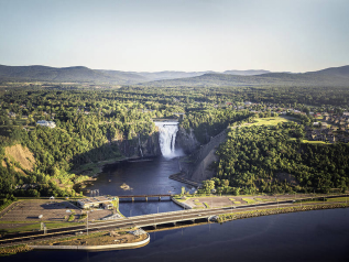
₋L'Ancienne-Lorette is a city in central Quebec, Canada. It is a suburb of and an enclave within Quebec City. It was merged with Quebec City on January 1, 2002 as part of a 2000–2006 municipal reorganization in Quebec, but after a 2004 referendum it was reconstituted as a separate city on January 1, 2006.
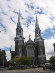
₋Its history dates back to 1674 when a group of Hurons fleeing war with the Iroquois settled there under the protection of the French. They left after a few decades and French settlers took over the land.
III.Economy
₋The average salary for an Agent is $785 per week in L'Ancienne-Lorette, QC, which is 9% above the national average. Salary estimates are based on 7 salaries submitted anonymously to Indeed by Agent employees, users, and collected from past and present job advertisements on Indeed in the past 36 months. The typical tenure for an Agent is less than 1 year.
₋Website: https://ca.indeed.com/salaries/agent-Salaries,-L'Ancienne-Lorette-QC
IV.Industrial Characteristics

₋Website: http://www.city-data.com/canada/L-Ancienne-Lorette-City.html
V.Attractions
1.Parc of the Kabir Kouba Cliff and Waterfall
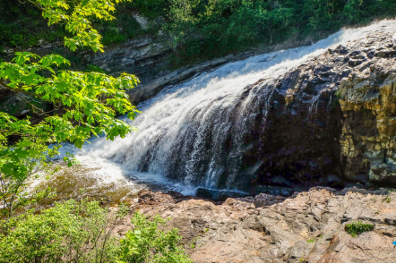
₋The Park of the Kabir Kouba Cliff and Waterfall is a public park in Quebec City, Quebec crossed by the Saint-Charles River. The rapids and falls of this section of the river are called Kabir Kouba the «river of a thousand bends» in the Montagnais language. An interpretive center and trails permit the observation of the Kabir Kouba waterfall that has a height of 28 metres. The trails also provide a view of the canyon which at its highest point measures 42 metres as well as a rich variety of flora, fauna and fossils dating over 455 million years old. The interpretive center also offers services such as Kabir Kouba by Lantern, A Day at Loretteville package as well as guided visits of the falls. A song by the singer Claire Pelletier, Kabir Kouba, evoques the many Huron legends that honour the river and the waterfall.
₋The waterfall is the point of encounter between two geological regions: The Saint-Lawrence lowlands (the park) and the Canadian Shield (the waterfall). It's in the sedimentary rocks of the park that we are able to observe fossiles dating from the era of the Iapetus Ocean.
₋In the same sedimentary rocks, it is possible to observe potholes, round holes formed by the circulation roration of small rocks. At the beginning, these small rocks are stuck in little depressions which gradually erode to form the potholes. The biggest pothole of the Park of the Kabir Kouba Cliff and Waterfall measures 5 feet deep.
₋We can also note the presence of erratic blocks in the park. These immense blocks were deposited on the site thousands of years ago by an enormous glacier that covered North America during the last ice age, called the Wisconsin glaciation. In the Quebec region, the glacier attained a depth of 3 km and its weight crushed the earth's crust. That's why, 18 000 years ago, the city of Quebec was 200m below the ocean.
₋The canyon of the Saint-Charles river was formed after the glacier's retreat, by the erosion caused by the flowing of water from the Saint-Charles lake. The latter was formed of hard and resistan rocks, gneiss, covered by much less resistant calcareous rocks. Consequently, the water eroded the calcareous rocks until it attained the resistant gneiss which resulted in the Waterfall and 42m high canyon. The rate of erosion of the canyon was an estimated 3.33mm per year.
₋Address: Chute, Kabir Kouba, La Haute-Saint-Charles, QC G2B 2T9
₋Phone: (418) 842-0077
₋Website: https://www.wander.am/travel/quebec-city-74892/places/parc-of-the-kabir-kouba-cliff-and-waterfall-103661
2.Parc des Chevaliers
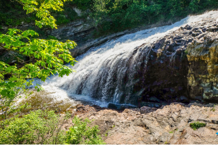
₋Located in the heart of the City, with a total length of almost 8 km, with an area of 56 HA and crossed by the Lorette river, the Parc de la Rivière is the source of happiness and pride for Lorettans and outdoor enthusiasts air in general. It is recognized for its vast urban forest, considered to be the largest in the region. A natural wealth without equal to the reach of all!
₋The Lorette river, which bears the name of the mission established for the Hurons in 1673, draws several pronounced meanders, around which we find a forest typical of the Laurentian maple groves and some herbaceous and shrubby spaces, vestiges of the rural history of the place. The complex offers diverse wildlife habitats that allow the observation and photography of a diverse winged fauna.
₋In summer, spring and fall, a network of trails is accessible to hikers and cyclists. By crossing tracks 2 to 4, which run along the river, you cross a mixed forest dominated by deciduous trees, especially maple. On runway 2, a belvedere offers a view of the river. The Parc de la Rivière also offers play modules, water games, a race track and several sports fields.
₋During the cold season, the trails are designed to allow hiking, cross-country skiing, snowshoeing and biking on snow (“fatbike”). Skating rinks, an ice ring and a slide complete the range of winter activities.
₋Address:
1575, rue Turmel
L'Ancienne-Lorette (Québec) G2E 3J5
₋Tél. : 418 872-9811
₋loisirs@lancienne-lorette.org
₋Website: https://lancienne-lorette.org/parcs-espaces-verts/parcs/
3.lac saint-augustin
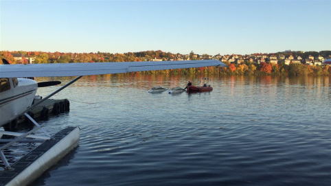
₋This park, which borders the south shore of Lake Saint-Augustin for a distance of 1.6 km, provides exceptional scenery for hikers in summer and winter. In addition to offering several views of the lake, it has an unmissable attraction called the Forest of Giants. This forest composed of mature hemlocks provides a magical atmosphere to the site. The park also includes sugar bushes and white birch groves, as well as a vast wetland. It extends east to the Orchard Park, where a purifying marsh, a meadow and several trees and small fruit shrubs, which attract several birds, rub shoulders. Swimming is prohibited in the lake, but a boat launching ramp allows you to practice nautical activities there.
₋Website: http://www.parcsnaturelsquebec.org/quebec/saint-augustin-de-desmaures/parc-riverain-du-lac-saint-augustin/
VI.History
₋A colony started when the Jesuit Pierre Chaumonot in 1674 when he built a chapel for the Hurons. Following his third and final trip to the shrine of Loreto in Italy, Chaumonot was cured of a terrible headache. In gratitude, he placed the colony under the patronage of Our Lady of the Annunciation, but it is still commonly called Lorette.
₋In 1697, the Hurons left in search of better land for hunting and fishing. Afterwards the site became known as Vieille-Lorette ("Old Loreto") or Ancienne-Lorette ("Former Loreto"). A new location became known as Nouvelle-Lorette ("New Loreto") or Jeune-Lorette ("Young Loreto"), and roughly corresponds to the Loretteville of today. A year later in 1698, the Parish of Notre-Dame-de-l'Annonciation was established.
₋In 1948, the place was incorporated as the village municipality of Notre-Dame-de-Lorette. In 1967, it gained town status and was took back its original name, L'Ancienne-Lorette, to distinguish itself from a Notre-Dame-de-Lorette Lac-Saint-Jean region.
₋Until 1971, L'Ancienne-Lorette was the gateway to Quebec's International Airport, which therefore used to be known as L'Ancienne-Lorette Airport. In 1971 the rural section of the town that included the airport was annexed by Sainte-Foy.
₋On January 1, 2002, L'Ancienne-Lorette was merged with Quebec City as part of a province-wide municipal reorganization and became part of the Laurentien borough of that city. After a 2004 referendum it again became an independent city on January 1, 2006.
VII.Other Information
₋The Ministry of Transport, Sustainable Mobility and Transport Electrification advises you that the work to widen and repair the Henri-IV highway, between the Charest highway and the Chauveau avenue, has gradually started in mid-July and will continue until November before a winter break. This major project will take place over a period of approximately five years.
₋This year, work will take place at the Henri-IV and Félix-Leclerc motorway interchange (east and west sectors) and the Henri-IV / Einstein interchange. The project will improve the security and efficiency of this strategic axis, in addition to ensuring the sustainability of infrastructure.
₋Website: https://lancienne-lorette.org/rues/travaux/
VIII.Contact Information
₋Government
Mayor: Vacant (substitute mayor: Sylvie Papillon)
Federal riding: Louis-Saint-Laurent
₋City Hall
₋Address:
1575, rue Turmel
L’Ancienne-Lorette (Québec) G2E 3J5
₋Tél. : 418 872-9811
₋Téléc. : 418 641-6019
₋Email: info@lancienne-lorette.org
₋Website: https://lancienne-lorette.org/nous-joindre/
