Duncan, British Columbia 作者: 来源: 发布时间:2021-05-25
I.Population and Area
₋Area
Land: 373.71 km2
₋Population (2016)
Total: 44,591
Density: 118.9/km2 (308/sq mi)

II.Natural Geography
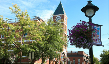
₋Duncan (pop. 4,944) is a city on southern Vancouver Island in British Columbia, Canada. It is the smallest city by area (2.07 square kilometres, 0.8 square miles) in Canada.
₋The city is about 45 kilometres from both Victoria to the south and Nanaimo to the north.
₋Although the City of Duncan has a population of just under 5,000, it serves the Cowichan Valley which has a population of approximately 84,000, many of whom live in North Cowichan and Cowichan Tribes. This gives Duncan a much larger perceived "greater" population than that contained within the city limits. People in areas of North Cowichan and bordering on Duncan usually use "Duncan" as their mailing address.
₋Duncan has one seat on the Cowichan Valley Regional District Board. The name Cowichan is an Anglicization of Halkomelem Quw̓utsun̓, which means "the warm land".
₋Transportation
₋The city is served by Trans-Canada Highway which connects the city to points north/south. Highway 1 through Duncan is a four-lane street with two signalized intersections (within the city limits) and a speed limit of 50 km/hr. British Columbia Highway 18 connects Duncan (via North Cowichan) to the town of Lake Cowichan to the west.
₋The Island Corridor Foundation railway continues to cross Duncan, though passenger and freight rail service on the south island corridor were both discontinued.
₋Public transit is provided in conjunction between BC Transit and the Cowichan Valley Regional Transit System. The service provides connections from Duncan to the surrounding communities as well as regular commuter bus service to Victoria.

III.ECONOMY
₋The average salary in Duncan, British Columbia is C$18.64. Trends in wages decreased by -100.0 percent in Q1 2020. The cost of living in Duncan, British Columbia is 100 percent higher than the national average. The most popular occupations in Duncan, British Columbia are Administrative Assistant, Cashier, and Dental Assistant (Certified) which pay between C$12.38 and C$31.15 per year. The most popular employers in Duncan, British Columbia are Cowichan Tribes, Dana Hospitality Inc, and The Home Depot Inc..
₋Website: https://www.payscale.com/research/CA/Location=Duncan-British-Columbia/Salary
IV.Industrial Characteristics
₋Duncan serves as an economic hub for the Cowichan Region. We provide healthcare, retail and professional services, and cultural tourism. We are a major business centre for the fishing, farming, forestry and tourism industries; key drivers of the regional economy.
₋Website: https://duncan.ca/visitors/about-duncan/
V.Attractions
1.Mount Tzouhalem

₋Mount Tzouhalem is a mountain on Vancouver Island, British Columbia, Canada, 4 kilometres east-northeast of Duncan in the municipality of North Cowichan. It is situated between Quamichan Lake, Maple Bay and Cowichan Bay.
₋The mountain is part of the municipal forest lands. Part of the mountain is an 18-hectare ecological reserve. It is popular with hikers and mountain bikers. It gives views towards Saltspring Island, the Coastal Mountains of the Lower Mainland and, on a clear day, Mount Baker in Washington State.
₋There is a large Christian cross on one cliffside. The original wooden cross, placed by local Catholic churches in the 1970s, was replaced by the Knights of Columbus with a welded version in the late 1980s.
₋The mountain was originally named "Shkewetsen" (meaning "basking" or "warming in the sun") by the local First Nations. According to legend, the local inhabitants fled to the mountain to escape the rising waters of a great flood. When the waters subsided, a frog was seen warming itself in the sun on a large rock on the side of the mountain. The frog rock formation was called "Pip'oom" (meaning "little swelled-up one").
₋The mountain was renamed after a preeminent Quamichan chief who lived his final years on the side of the mountain after being banished by his own people.
₋Born of a Quamichan man and a Comiaken woman, Tzouhalem was trained to be a warrior by his grandmother. He was infamous for his combative and unruly behaviour. His fighting prowess probably helped establish Quamichan as the largest and wealthiest of the Cowichan villages.
₋In addition to defeating northern invaders near Maple Bay, in part by disguising warriors in canoes as women, Tzouhalem assumed command of the First Nations attacking Fort Victoria in 1844. Enraged by the fort's demands for compensation or punishment following the slaying of some ranging cattle, Tzouhalem's warriors peppered the fort with threats and musket balls for two days until its Chief Factor Roderick Finlayson arranged for demonstrations of the fort's nine-inch cannons. After the cannons destroyed a cedar-bark hut and a canoe, the parties negotiated compensation to resolve the dispute and Tzouhalem withdrew his forces.
₋Because of his frequent murders, Tzouhalem was at last banished by his fellow tribesmen, and took up residence in a cave on the side of Mount Tzouhalem. He had fourteen wives living with him, most of whom had been widowed by him. In 1859, when trying to gain another wife from Penelakut Island (Kuper Island until 2010), he was killed by her or her husband.
₋The mountain served as the target for the cannons of HMS Trincomalee of the Royal Navy's Pacific Squadron when it signalled its arrival in Cowichan Bay. Early maps by the British identified the area as "Tzohailim Hill" (1855) and "Tzohailin Hill" (1864). In 1911, the Geographical Names Board of Canada adopted "Tzuhalem Mountain". In 1950, the form of name changed to "Mount Tzuhalem" until the spelling was altered to Mount Tzouhalem in 2000 to align with the local, traditional spelling supported by the Cowichan Tribes band government.
₋Website: https://www.victoriatrails.com/trails/mount-tzouhalem/
2.BC Forest Discovery Centre

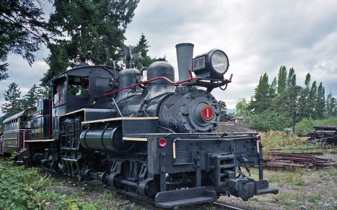
₋The BC Forest Discovery Centre, located in Duncan, chronicles the history of logging in British Columbia, Canada. It is a 100-acre (40 ha) site with 2.5 km (1.6 miles) of operational 3 ft (914 mm) narrow gauge railway.
₋G.E. (Gerry) Wellburn, a collector, was the founder of the Centre which opened in 1965 as the Cowichan Valley Forest Museum. It was later known for a time as the BC Forest Museum.
₋There are indoor and outdoor exhibits spread over a 100-acre (40 ha) site, including operating steam and gas rail equipment plus logging trucks. There are forest and nature trails, picnic area, playground, gift shop and a concession. At the Centre visitors can explore a reconstructed logging camp, forest fire lookout tower and the ranger's station.
₋The Centre has its own heritage railway, a train pulled by a century old steam locomotive which was once used in the filling in of the North Vancouver harbour. Along the route is one of the first pre-fabricated school houses, a trestle over Somenos Lake and an operational water wheel.
₋Address: 2892 Drinkwater Rd, Duncan, BC V9L 6C2
₋Phone: (250) 715-1113
₋Website: https://bcforestdiscoverycentre.com/
3.Quamichan Lake

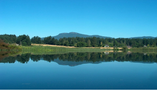
₋Quamichan Lake is a lake in the Cowichan Valley region of Vancouver Island, British Columbia, Canada, located three kilometres to the northeast of the City of Duncan.
₋Quamichan Lake and its sister Somenos Lake were created 11,000 years ago by receding glaciers. Both lakes contribute to Cowichan River. Quamichan Lake's outflow is Quamichan Creek which joins with Somenos Creek, the outflow from Somenos Lake, which flows to Cowichan River.
₋The Cowichan Watershed Board identifies a common set of conditions for both shallow lakes:
excessive nutrient loading from the farms and homes which surround the lakes
insufficient "flushing" in summer due to reduced inflows and truncated outflows
increased plant growth ("algae-blooms"), and
eutrophication (reduced oxygen as the vegetation decomposes)
intensified warming
₋In autumn 2016, the lake's algae received public attention after news coverage of its killing at least four dogs.
₋Website: https://www.northcowichan.ca/EN/main/departments/environmental-services/quamichan-lake-blue-green-algae.html
VI.History
₋The community is named after William Chalmers Duncan (born 1836 in Sarnia, Ontario). He arrived in Victoria in May 1862, then in August of that year he was one of the party of a hundred settlers which Governor Douglas took to Cowichan Bay. After going off on several gold rushes, Duncan settled close to the present City of Duncan. He married in 1876, and his son Kenneth became the first Mayor of Duncan. There is a Kenneth Street, as well as a Duncan Street, in the City.
₋Duncan's farm was named Alderlea, and this was the first name of the adjacent settlement. In August 1886, the Esquimalt and Nanaimo Railway was opened. No stop had been scheduled at Alderlea for the inaugural train bearing Sir John A. Macdonald and Robert Dunsmuir. However, at Duncan's Crossing, the level crossing nearest Alderlea, a crowd of 2,000 had assembled around a decorated arch and the train came to an unplanned halt, quite literally putting it on the map.
₋In the early 1900s, Duncan's Chinatown was the social centre for the Cowichan Valley's Chinese population. Chinatown was concentrated in a single block in the southwestern corner of Duncan. At its largest point, Duncan's Chinatown included six Chinese families and 30 merchants who supplied goods and services to the loggers, millworkers, cannery and mine workers in the area. The city tore the buildings down in 1969 to build a new law courts complex. Some materials from the original buildings were used at Whippletree Junction.
₋In the 1980s, the city was noted i coverage related to the 1985 bombings at Narita Airport in Japan and aboard Air India Flight 182, Canada's largest murder case. Resident Inderjit Singh Reyat purchased bomb parts and a radio at Duncan stores, and used the radio to conceal the bomb. Less than two weeks prior to the bombings, Reyat and suspected Air India mastermind Talwinder Singh Parmar were observed testing explosives in the woods outside of Duncan by the Canadian Security Intelligence Service (CSIS).
VII.Other Information
₋Education
₋Duncan is part of British Columbia's School District 79 Cowichan Valley. It has one independent school. Queen Margaret's School, established in 1921, as a private secondary university preparatory school for girls which includes a co-ed junior school.
₋Vancouver Island University (formerly Malaspina University-College) has a regional campus in the Municipality of North Cowichan, bordering Duncan, that offers a Bachelor of Education degree as well as programs and courses in university transfer, access, trades and applied technology, health and human services, and career and academic preparation. The campus also has a Continuing Education department that offers certificate programs, personal and professional development courses, and online courses. The current 55,000-square-foot (5,100 m2) campus opened for classes in June 2011.
₋Also bordering Duncan in the Municipality of North Cowichan, there are two public secondary schools, Cowichan Secondary School, and Quamichan Secondary School, as well as several elementary schools. The head offices of School District 79 Cowichan Valley are also located in North Cowichan. In the Cowichan region there are also has two denominational independent schools: Queen of Angels (Catholic school), serving preschool to Grade 9 students, and Duncan Christian School, whose campus is home to both an independent elementary and high school. Sunrise Waldorf School is a non-denominational K-8 independent school offering Waldorf education in the Cowichan Valley.
₋Infrastructure
₋Duncan has the infrastructure that business requires. There is fibre optics telecommunications, comprehensive coverage for cell phones and good water and sewer systems. Ample retail and office space is available in the City boundaries, along with light industrial land outside.
₋Website: https://duncan.civicweb.net/document/55890
VIII.Contact Information
₋Government
Governing body: Duncan City Council
Mayor: Michelle Staples
₋City Hall
200 Craig Street
Duncan, BC V9L 1W3
Phone: 250.746.6126
Fax: 250.746.6129
duncan@duncan.ca
₋Website: https://duncan.ca/city-hall/city-directory/
